Five Airports, One Beautiful Afternoon
By Bryan Gmyrek, CFI/CFII at Arlington Municipal Airport (KAWO).
There’s a particular kind of weather window in the Pacific Northwest that I’ve learned to recognize: a high builds in, the wind lays down, the marine layer agrees to behave for a few hours, and the islands open up. When that window appears and the calendar happens to be clear, I go.
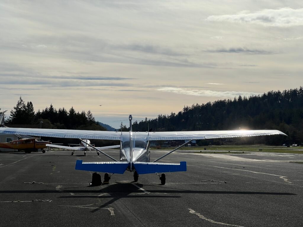
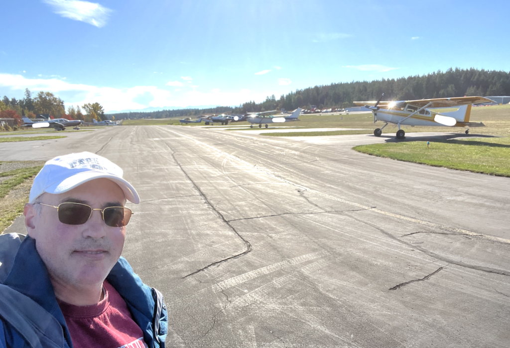
This was one of those days. No student, no passenger, no schedule beyond what the airplane and the weather would let me do. Just me, Thomas, and a plan to land at five airports in the San Juans and come home.
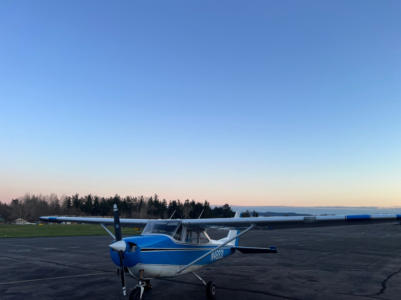
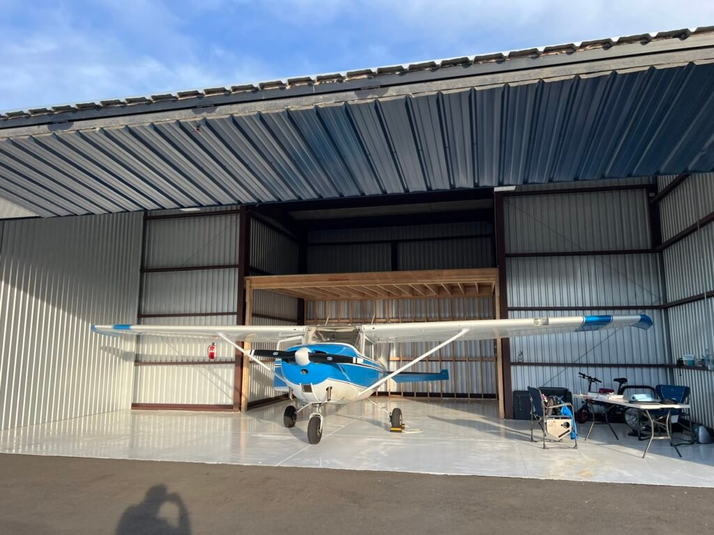
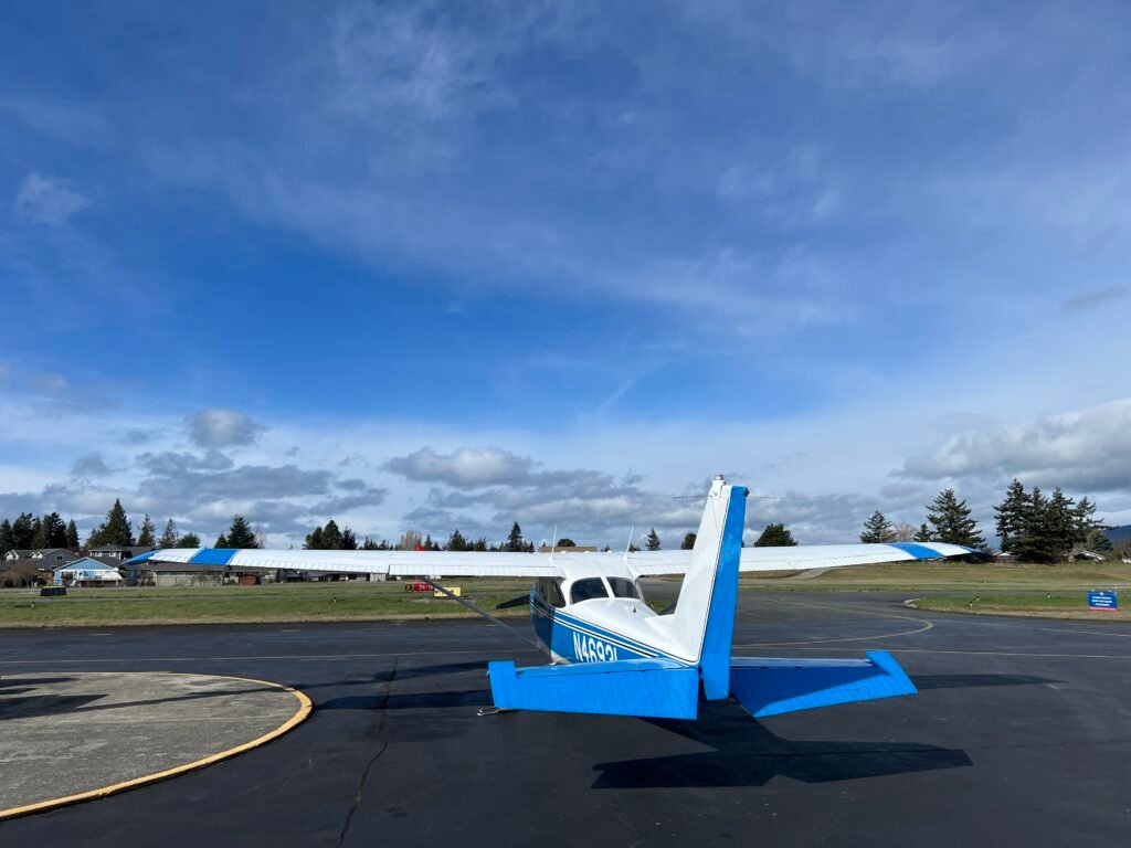
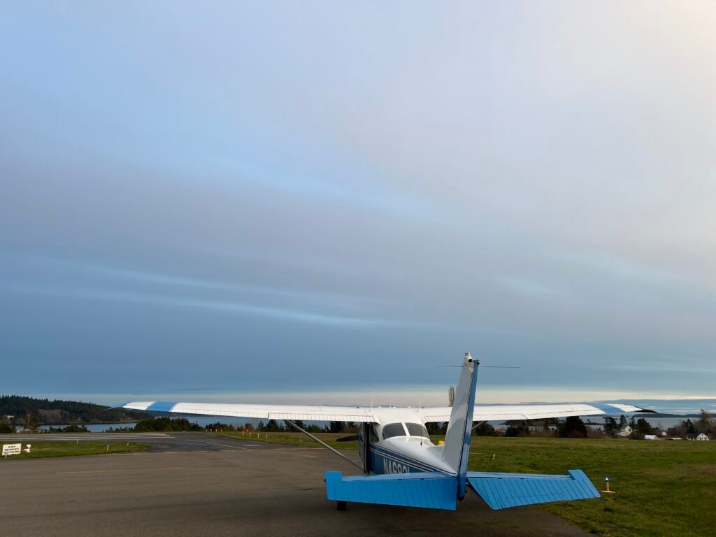
A quick note about Thomas: he’s a Cessna 172, and yes, he’s named after Thomas the Tank Engine. Thomas, as any small child will tell you, wants to be a Really Useful Engine. Thomas is the same — a happy, willing little airplane that just wants to be useful. We’ve flown more than 400 hours together in the past year, including a solo trip from Atlanta to Arlington when I first brought him home, and a round trip from Snohomish to San Diego and back. He’s the right airplane for this kind of day.
Worth saying out loud: a lot of pilots look at the 172 and see “just” a trainer — something to log hours in until you move up to a “real” airplane: something with more horsepower, something built for the backcountry, something flashier. I’ve come around to a different view, and Thomas is most of the reason. For a huge range of genuinely ambitious, fun flying — short fields, long cross-countries, island hopping, sightseeing days like this one — the 172 isn’t merely adequate. It’s perfectly capable. Atlanta to Arlington solo, Snohomish to San Diego round trip, and all five of the airports in this post — Thomas has yet to feel like the limiting factor on any flight I’ve planned around him.
The plan: Arlington (KAWO) → Anacortes (74S)→ Orcas (KORS) → Roche Harbor (WA09) → Friday Harbor (KFHR) → Lopez (S31) → Arlington (KAWO) . Five island stops in a single afternoon, each with its own character, each with something I look forward to every time.
My motto for days like this is the journey is the destination. I don’t always step out at every stop. The flying itself is the point.
The Run Up the Valley
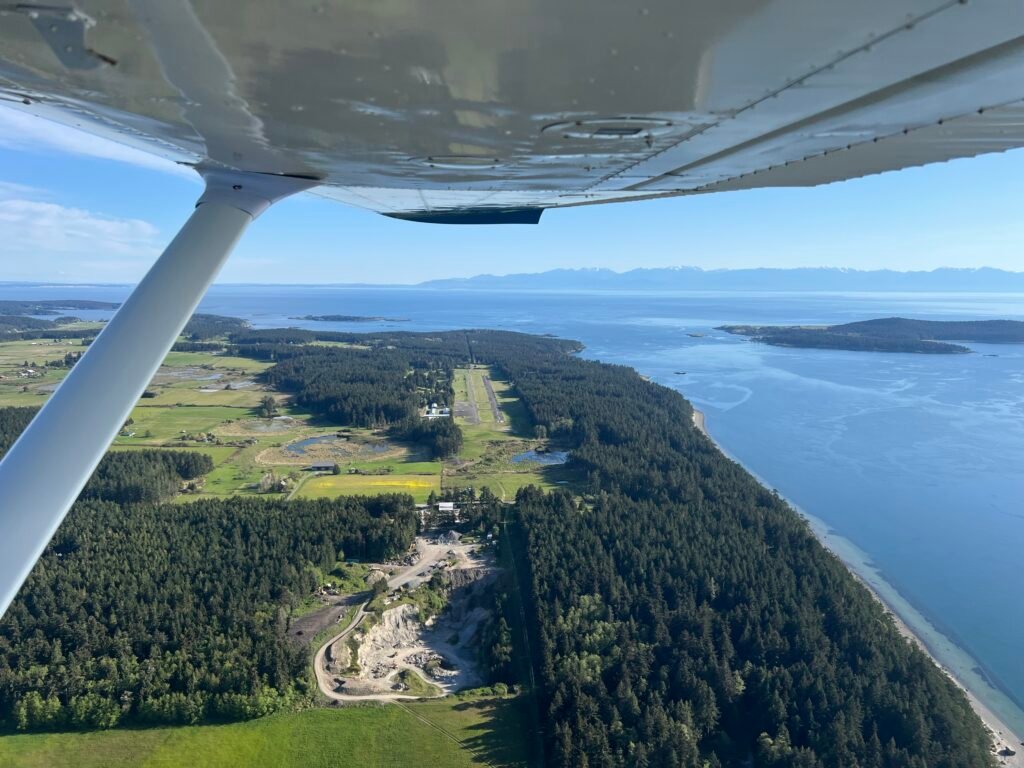
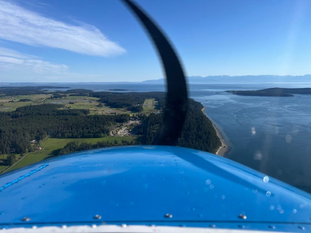
The leg from Arlington to Anacortes is short — about thirty nautical miles, roughly fifteen minutes at cruise — but it’s one of my favorite stretches of flying anywhere. The Skagit Valley unrolls beneath me in a patchwork of farms, sloughs, and river channels, with Mt. Baker sitting on the eastern horizon like it’s posing for a portrait.
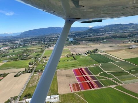
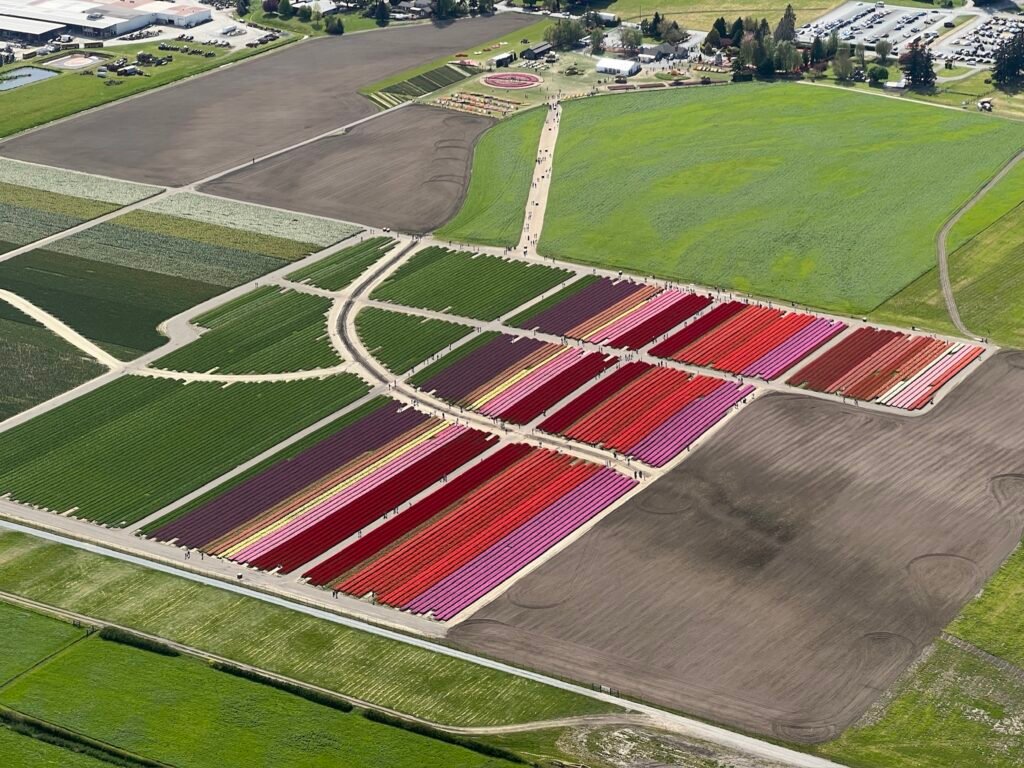
In spring, the valley does something genuinely special. The daffodil fields come in first — wide blocks of saturated yellow against the green and brown of the surrounding farmland. A few weeks later the tulips take over, and from a thousand feet up the fields become improbable stripes of red, white, magenta, and deep purple. The Skagit Valley Tulip Festival pulls hundreds of thousands of visitors to the area every April, and I’ve been one of them — walking the rows on the ground, taking the same photos everyone takes. Seeing those fields from the air is a different experience entirely. The patterns only really make sense from above. I catch myself grinning at the airplane like a kid.
A little farther on, La Conner appears below — the Swinomish Channel cutting between Fidalgo Island and the mainland, the marina full of boats, the little town strung along the waterfront. It looks like it was designed to be photographed from a Cessna.
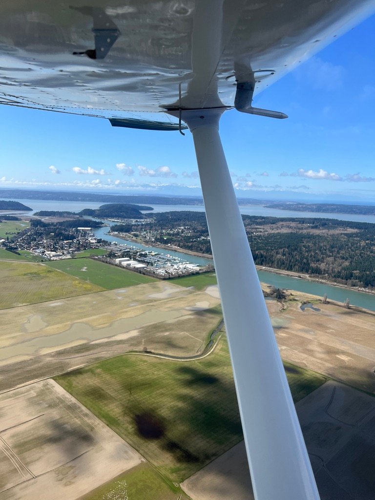
By the time I cross over the channel and the islands open up to the west, I’ve already done some of the most beautiful flying available in the Pacific Northwest, and I haven’t even reached the islands yet. The flats give way to water. Anacortes appears off the nose. The day starts to feel like the day it’s going to be.
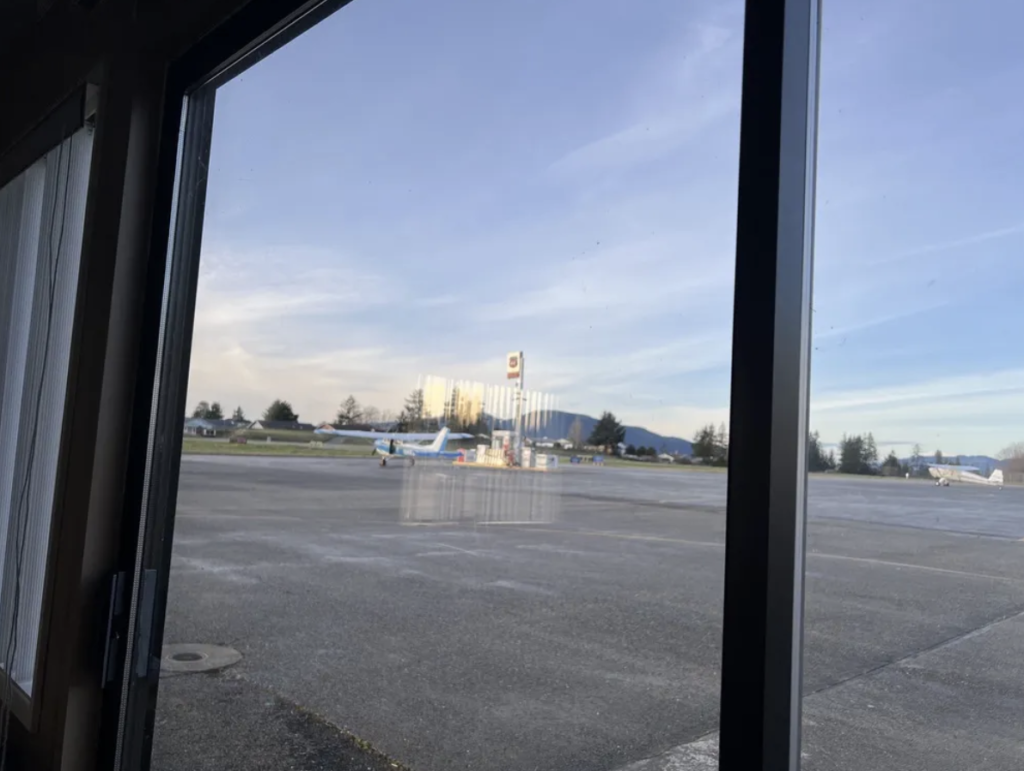
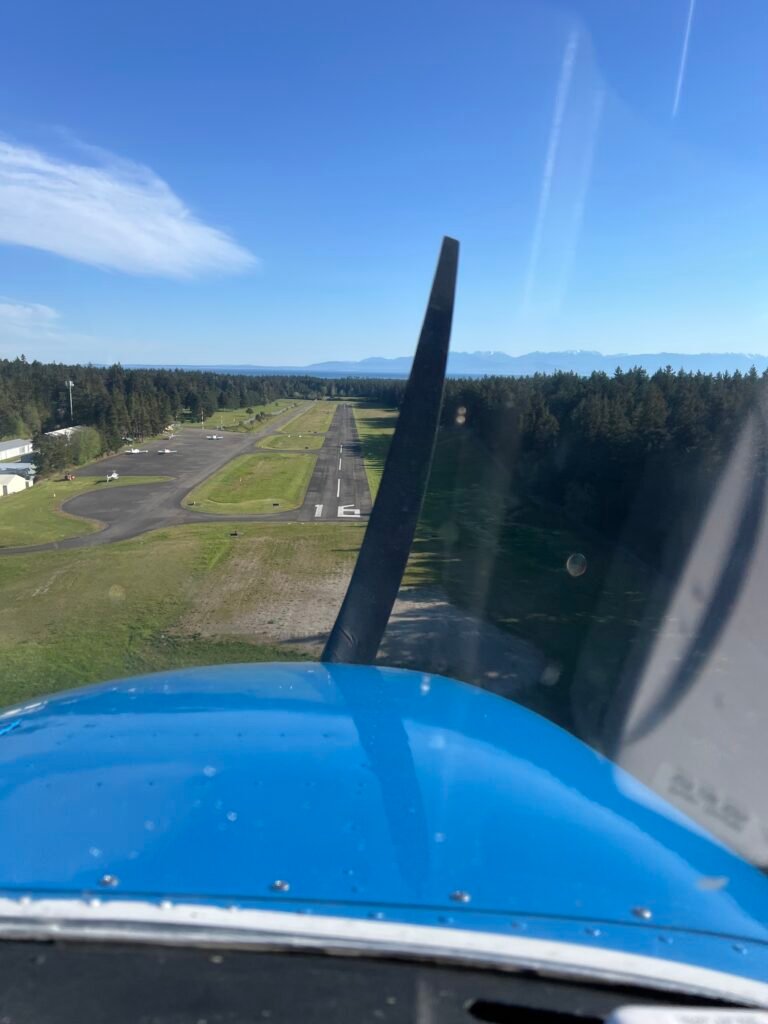
Anacortes (74S) — The Gateway
What amazes me about Anacortes is how close it is. Roughly thirty nautical miles from Arlington — barely time to settle in at cruise before I’m dialing in the next CTAF. And yet, the moment the ramp comes into view, I’m somewhere else entirely. Anacortes is easy to get to, but a world away. The gateway to the islands.
I always feel lucky that I get to land there.
There’s one piece of airspace I’m always tracking around here: the Class C surrounding NAS Whidbey Island. It extends well past Whidbey itself, with stepped floors that vary by sector, and the floors get lower as I head south and west. I think about it every time I’m in this airspace, and I always check the chart for the exact altitudes before I get there.
On nice days, the airspace around NAS Whidbey is busier than the chart suggests — small aircraft funneling through the gateway in numbers, and military traffic flying instrument approaches into NUW in any weather. I’ve found ATC to be reliably accommodating about Class C transitions, and I almost always pick up flight following before I leave Arlington. Even when I’m not talking to them, I’m listening to Whidbey on the radio. There’s a lot of metal moving around up there, and the situational awareness is worth the frequency slot on my radio.
The wind was up a little when I arrived — nothing alarming, but enough that I’d already promised myself a low approach if anything felt off. That’s a habit I’ve built, and it’s served me well out here. Wind in the islands is rarely what the nearest AWOS reports. Terrain channels the regional flow between the islands, high points like Mt. Constitution kick up mechanical turbulence on their lee sides, and on warmer days there are land-and-water thermal gradients adding their own local circulations on top of the synoptic picture. The result is that conditions on short final at a small island strip can differ meaningfully from what was reported five minutes ago, five miles away.
What I’ve learned is that the wind out here often has lulls. The sock will be pinned for a stretch and then relax for a stretch. If my approach lines up with one of the calmer pockets, I land. If it doesn’t, I go around and try again. Patience is a flying skill I’ve gotten plenty of practice with in these islands.
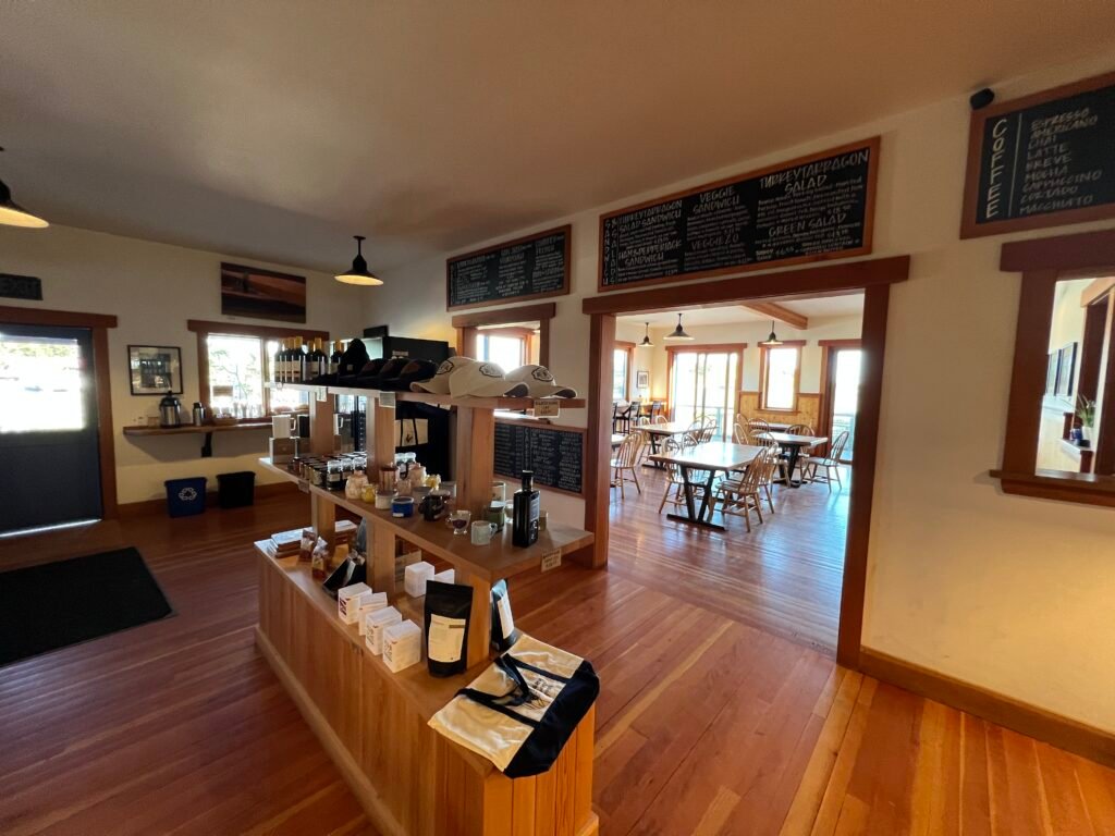
Anacortes has historically had some of the friendlier fuel prices in the area, which is reason enough for me to make it a regular stop. But the real reason I like landing here is the rhythm of it. I taxi off the runway, shut down at the pump, top off the tanks, and then — if I’m not in a hurry — I wander into the pilots’ lounge.
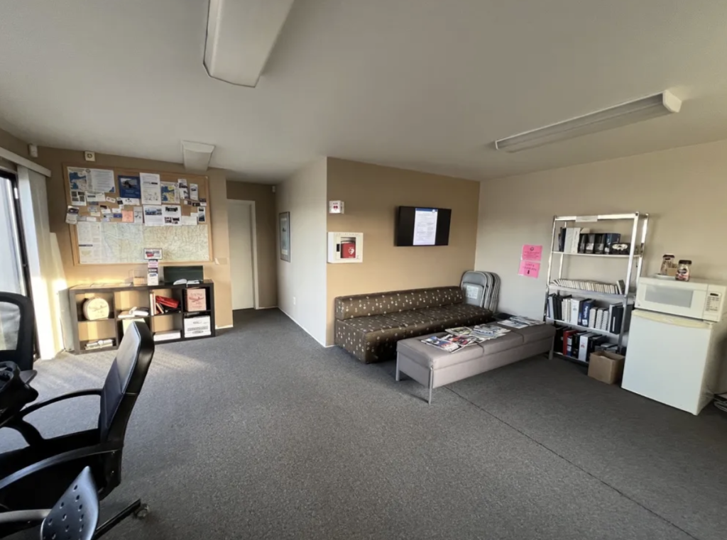
Most small airports have a lounge like this, and every one of them is a little different. Anacortes’s is comfortable in the way these places are supposed to be: a couch that’s seen some years, a chart pinned to the wall, brochures for places in town, a microwave for the pilot who packed leftovers. There’s something quietly wonderful about being the only one in there for a few minutes. I sit. I drink the coffee. I watch my airplane through the window.
That’s a kind of solitude I don’t really get anywhere else.
When I was ready, I walked back out, climbed in, and pointed Thomas toward Orcas.
Orcas Island — Eastsound (KORS)
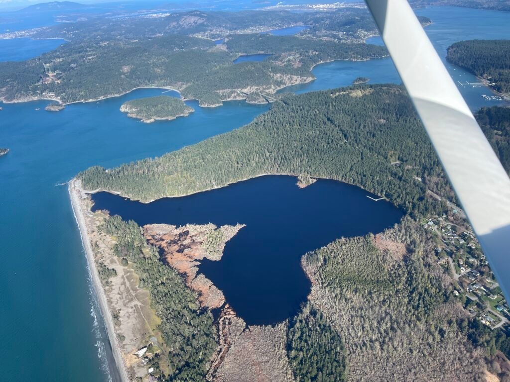
Departing Anacortes northwest, the islands open up below and Mt. Baker holds court on the eastern horizon. Off my left wing, Blakely Island slides past with its private strip, 38WA, tucked into the trees — one of many small airports and airstrips scattered across the San Juans.
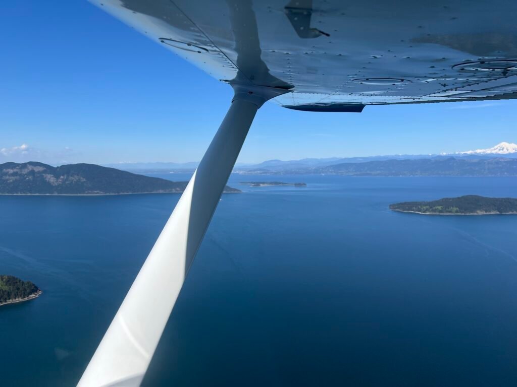
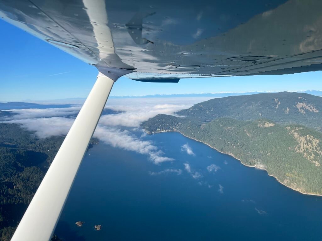
When the winds favor 16, my standard arrival into Orcas is to come up East Sound from the south, set up for a 45 to the left downwind, and land toward the village of Eastsound at the head of the inlet. East Sound itself is one of the most striking pieces of flying anywhere in the chain — a long fjord-like cut between the eastern and western lobes of Orcas Island, water below, Mt. Constitution rising 2,400 feet on the right.
Then comes the part of Orcas that earns its reputation. There is rising terrain on the southwest side of the airport. On final to 16 I’m heading south, which puts that terrain off my right wing. The pattern at Orcas is configured to keep airplanes east of the runway — left traffic for 16, right traffic for 34. But the pattern only protects you so far. The discipline that matters most is on final and on the missed: stay on centerline. Drift right on a go-around from 16 — exactly the moment when the instinct is to look at the village off the left wing and away from the trees off the right — and the consequences get real fast. I stay on centerline.
This is also the airport that taught me what marine fog can do. I’ve come up to Orcas on a day when the layer was sitting right on the field — solid enough that even San Juan Airlines was holding off — while Friday Harbor, about a dozen miles southwest, was clear and dry. So I went to Friday Harbor. That’s the whole game with island weather: the conditions twenty miles away are not the conditions here, and the pilot who plans for one set of weather across the whole chain is the pilot who gets surprised. I always file an alternate in my head before I leave Arlington, even on a beautiful day.
On this trip, conditions were fine. I touched down on 16, taxied back on the parallel taxiway, and lined up to depart again. I don’t always need to step out at every airport — the flying itself is the point. But Orcas rewards the pilot who lingers. The pilots’ lounge is comfortable, San Juan Airlines Cessna Caravans come and go on the same ramp as Thomas, there’s a covered picnic area for a sandwich, and Eastsound village is a short walk away if you’ve built in the time. Airplane camping too — pitch a tent next to your airplane and wake up in the islands. And at every participating airport in the state, you can collect stamps for the Fly Washington Passport program. It’s a small thing, but it’s the kind of small thing that makes a flying day feel like a treasure hunt.
Then back into the airplane, run-up, and back into the air. San Juan County asks pilots to fly neighborly with as much altitude as practical over the islands, and I climb high and stay high. The people who live here share the airspace with us, and I want to be a good neighbor. Climbing out, Sucia Island appears off the wing, those distinctive curving fingers of the marine state park unmistakable from above.
Roche Harbor next.
Roche Harbor (WA09) — The Private Airport
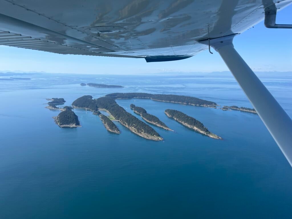
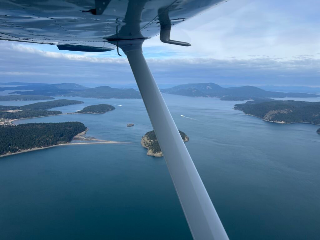
Departing Orcas to the northwest, I almost always route over Sucia Island even when it isn’t the most direct line. Sucia is a Washington State Marine Park — accessible only by boat, except from the air, where I get the view almost no one else does. Those distinctive curving fingers of land, the boats anchored in Echo Bay, the whole shape of the place revealing itself as I pass overhead. It’s a small detour. It’s worth it every time.
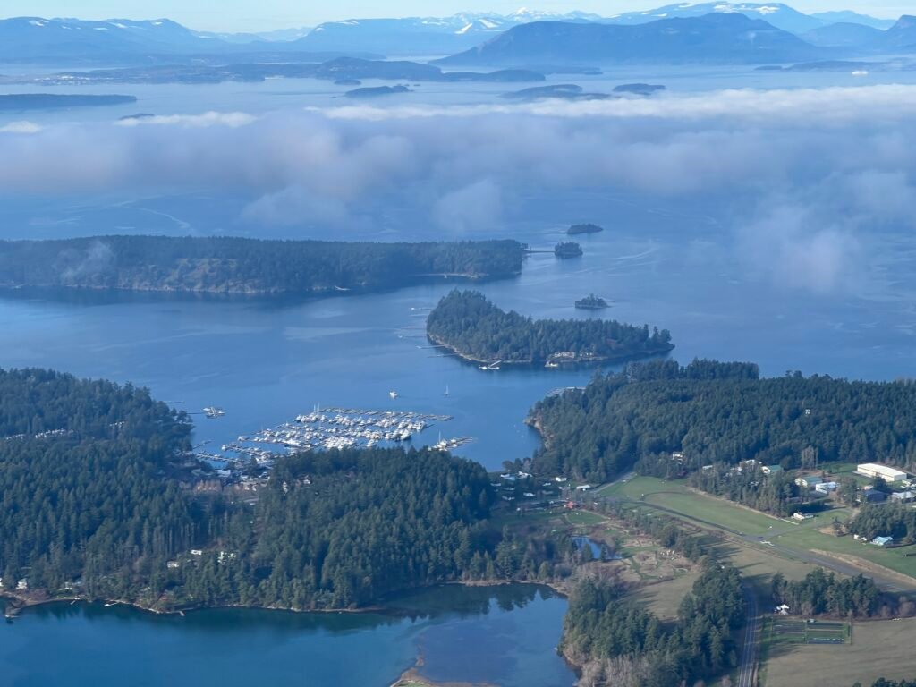
After watching Orcas island off my left wing for a while my attention turns to San Juan Island and Roche Harbor. The marina comes into view first — slips packed with yachts and sailboats — and then the historic resort, the white clapboard buildings of the old lime works district, the Hotel de Haro flying its flags. The airport itself is harder to spot. WA09 is tucked into the trees south of the resort, a single narrow runway that doesn’t really announce itself.
In my humble opinion, Roche is the most challenging airport on this route, and it’s worth understanding why. It’s a private airport, public-use during daylight— there’s a $10 landing fee honor box. The runway, 7/25, is roughly 3,600 feet long and only 30 feet wide. That’s narrow. Most of us are used to runways 50, 75, even 100 feet wide; 30 feet doesn’t leave much room for sloppy alignment. The runway also isn’t flat so there’s no line of sight between the two ends. The wind socks at opposite ends of the field will sometimes point in different directions, which tells me something important about how the local terrain is shaping the wind that day. There’s rising terrain to the south, which makes a standard 45° pattern entry awkward, and rising terrain to the east that I have to think about on departure.
My preferred operation at Roche is to land towards the east on 7 and depart to the west on 25 (depending on the winds of course – but these are my preferred runways). Landing east gives me better visibility of airplanes taxiing from the parking area, and keeps me away from the rising terrain on landing. Departing west on 25 spits me out over the water — exactly where I want to be when I’m in a 172 climbing slowly on a warm day, rather than over rising trees. The noise abatement procedure calls for climbing straight ahead before turning. Roche Harbor’s neighbors share the airspace with us, and the resort has worked hard to keep the airport open. I climb straight ahead before turning, every time.
The narrow runway puts a premium on centerline discipline at three different moments: on landing, on the takeoff roll, and — of course — on the initial climb. Trees flank the runway closely on both sides, and drifting off centerline in the climb-out is exactly the moment when I’m least equipped to correct it: nose high, climb rate modest, sight picture limited. I know it’s hard to see straight ahead when the nose is up, but I use the lindbergh reference, heading bug, whatever tools I have available to stay centered.
A couple of other things I keep in my scan at Roche: deer and geese. Both are routine visitors to the runway environment, and both will absolutely ruin a day if I don’t see them in time. I look hard before every takeoff and on every short final. And one more wrinkle that catches first-time visitors off guard: depending on which direction I’m operating, I may need to taxi on the runway itself. There isn’t a full parallel taxiway. Radio discipline matters here. I announce on CTAF, announce again, and look — really look — before I back-taxi.
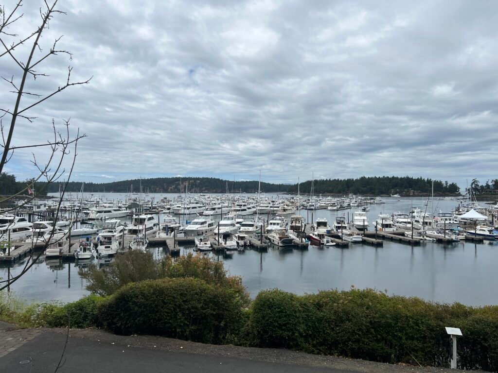
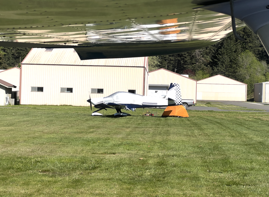
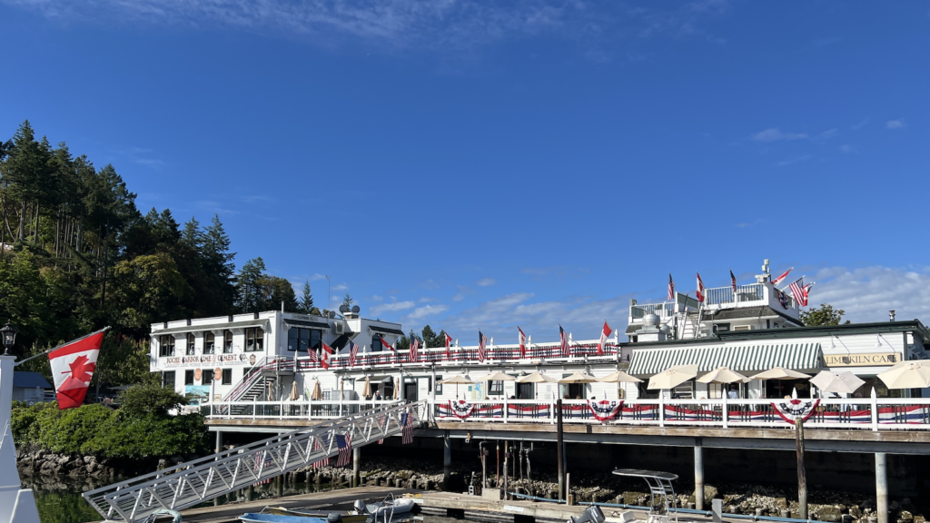
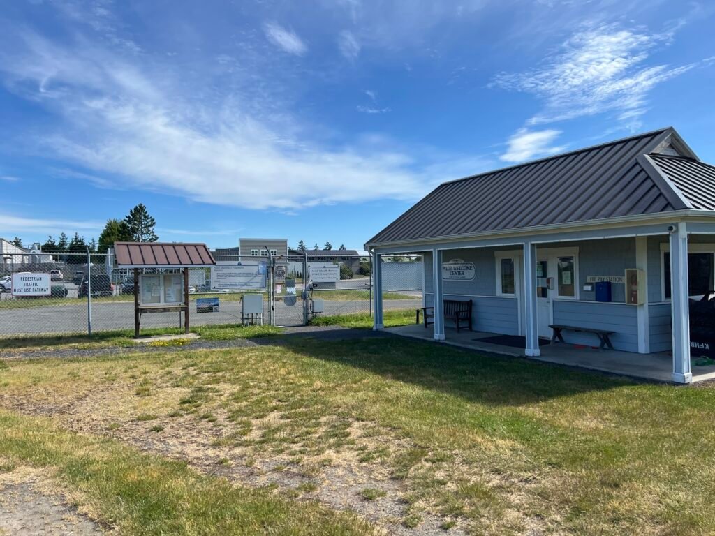
When I want to stay for a while, I park Thomas on the grass – if you’ve never done this before it feels pretty adventurous. I remember to set my fuel selector to only one side to avoid fuel siphoning from one wing to the other. Once Thomas is secure, the walk into the resort is short and easy. If I’m hungry I usually go to the Madrona Bar & Grill for a delicious Tuna Poke Bowl and some Truffle Fries. The marina is one of the most photogenic places in the islands: yachts and sailboats packed in close, the historic Hotel de Haro and the old Lime Kiln Café, the broader harbor where Kenmore Air’s Beavers and Otters land and take off on the water. Those seaplanes are worth watching for two reasons — they’re beautiful, and they’re traffic. If I’m departing while a seaplane is operating in the harbor below, my situational awareness extends down to sea level. There’s also a disc golf course winding through the woods if I’ve got the time, and the Westcott Bay Sculpture Park sits right next to the airport — outdoor sculptures scattered across meadows, a surprising and lovely thing to find a few hundred yards from where I tied down. If I happen to be there at sunset I watch the really cute flag ceremony – trust me its worth it – but not today.
Then back to the airplane, $10 in the box, run-up, and a westbound departure off 25. Centerline. Centerline through the climb-out. The trees give way to water, and Friday Harbor is a five-minute hop to the south.
Friday Harbor (KFHR) — The Hub
If Anacortes is the gateway and Roche is the private airport, Friday Harbor is the hub. It’s the busiest field in the chain by a noticeable margin, the most popular destination, and the airport I actually stop at when I’m flying the islands. It’s where I went on this trip.
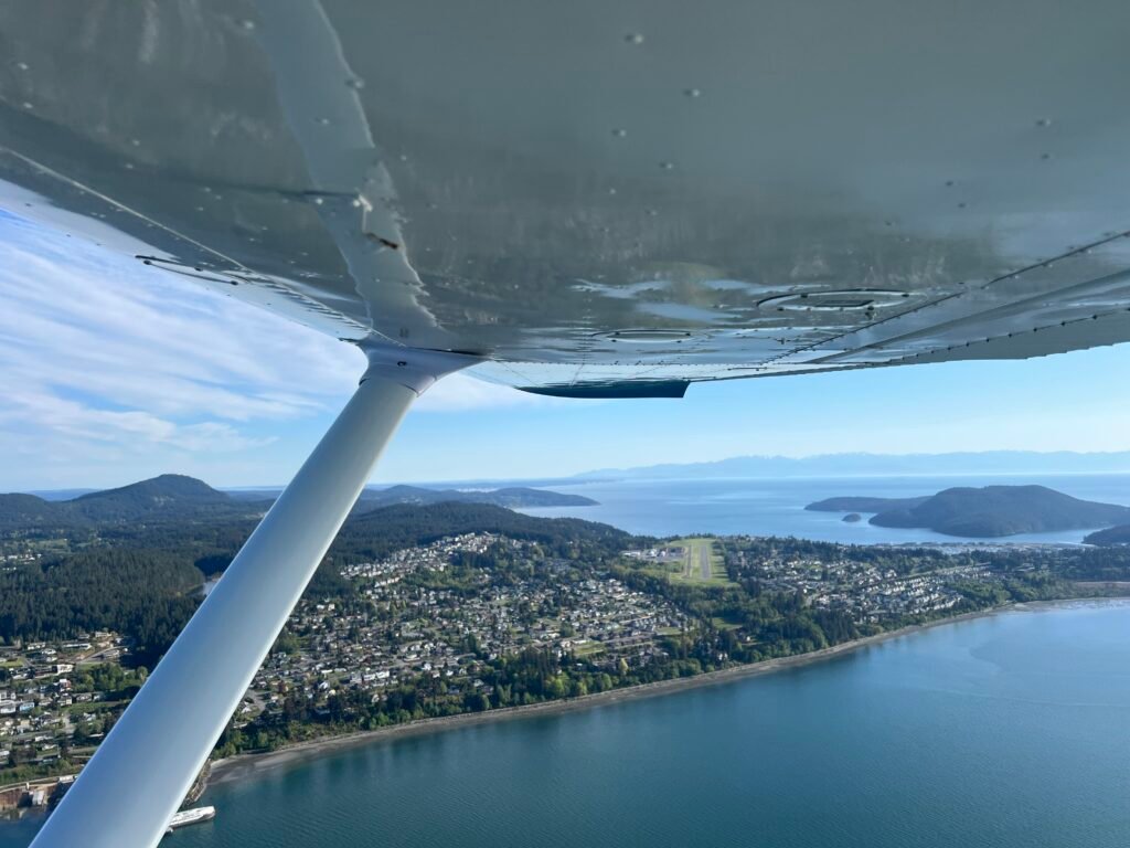
Friday Harbor is set back from the water on the south side of San Juan Island, with the town of Friday Harbor a short walk down the road. Depending on how traffic is landing I either fly down the east side of San Juan Island or the west to enter a 45 degree to the downwind. Both sides of the island are beautiful, but if I fly down the west side I’m careful to stay out of Canadian airspace. If I stick near the land its no trouble though. KFHR has a single runway, 16/34, and on a nice day the pattern can have several airplanes in it. It’s not chaotic — it’s just busier than the rest of the route. I stay current on my traffic pattern procedures and approaches, so the volume here doesn’t worry me, but it’s the airport on this route where situational awareness on the radio earns its keep.
One thing worth knowing: there’s an instrument approach to runway 34, so on a busier day I’ll occasionally hear someone calling positions on the approach rather than in the visual pattern. I fold them into my mental picture and work with it. They have somewhere to be too.
On this particular day the winds were favoring 16 so I flew along the west side of San Juan island, near Lime Kiln Point State Park and the Lime Kiln Lighthouse. I always find the visual pattern into 16 a little interesting. Something about the way the terrain falls away makes me feel like I’m sinking too low on base and final — like the airplane wants to be higher than my eyes are telling me. Every time. I’ve come to recognize the feeling for what it is: a sensory illusion, not a real altitude problem. If my pattern altitudes are right and my airspeed is right and my power settings are right, the airplane is exactly where it should be regardless of what my gut is telling me. Trust the process. Fly the numbers. Watch for anything genuinely unusual. The airplane doesn’t lie; the eye sometimes does.
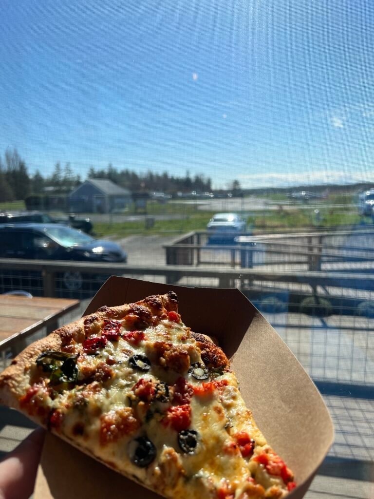
This was my one full stop on the day, and Friday Harbor is the right airport to make it. The airport sits right at the edge of town, and Bakery San Juan is essentially next door — I think of it as an honorary airport restaurant because it’s a one-minute walk from the ramp. They make really good pizza. They usually have “Joe’s” peach tea, which I look forward to every visit. And right nearby is the San Juan Island Food Co-op, which is the small grocery store you go to when you want a chocolate bar, or a sandwich for later cockpit, or whatever else you forgot to pack.
A note about island flying lunches, though: always pack a sandwich. Sure, the journey is the destination, but the actual destination doesn’t always have a kitchen open. Bakery San Juan keeps reasonable hours during the week – but they’re closed on weekends so on a Saturday or Sunday afternoon (or on a holiday), you can absolutely fly to a beautiful island, walk a hundred yards to your favorite spot, and find it dark. A trusty sandwich in the airplane has saved me more than once. The same goes for water. Plan for the version of the day where nothing is open. Then anything that is open becomes a bonus.
Beyond Bakery San Juan and the Co-op, the town of Friday Harbor itself is a longer walk, a bike ride, or an Uber. I keep a foldable electric bike in the airplane for exactly this purpose — at most island airports, having your own wheels turns a quick stop into a real visit. On other days I’ve ridden down to the harbor, watched the ferry come in, wandered the waterfront. On this day I had pizza and stayed close. Lopez Island awaits!

Then back to the airplane, prepare for the very brief trip to Lopez, run-up, line up and depart on runway 16.
Departing on runway 16 is nice because the terrain is relatively flat in that direction, and if I continue the departure path towards the south coast I can overfly the famous American Camp and then head east to fly over Cattle Point Light House. I make sure to call out these visual points and my distance/direction from the airport so other arriving and departing pilots are aware of my location.
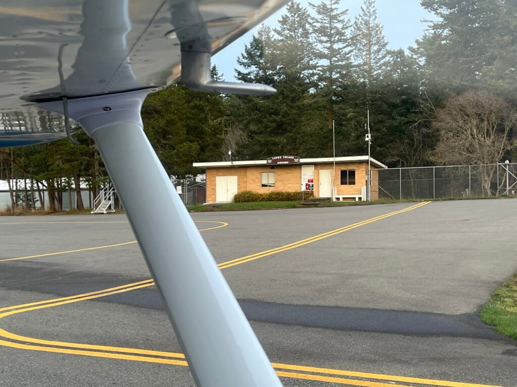
Lopez Island (S31) — Slowpez
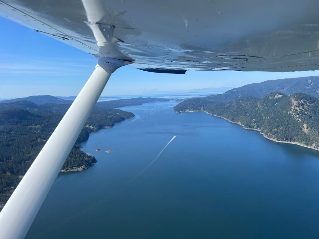
The hop from Friday Harbor to Lopez is barely worth calling a hop. Six minutes, give or take. As I climb out of 16 at KFHR, the airport at S31 is essentially already in sight, tucked into the trees on the north end of Lopez Island. Below, the Washington State Ferry routes thread between the islands, white wakes pointing toward Anacortes.
Some people lovingly call call Lopez Slowpez — slower than Friday Harbor, smaller, quieter, an island that feels like it’s letting the rest of the world hurry on by without it. The airport matches the personality. There’s no terminal bustle, no scheduled-airline ramp, just a small brick building, a tied-down line of single-engine airplanes, and a runway running roughly north-south through a forested clearing.
For me, Lopez is the second most challenging airport on this route , though “challenging” is maybe the wrong word for it. It’s not dramatic. It’s just an airport that rewards precision. The runway, 16/34, is 2,905 feet long and 61 feet wide, which is plenty for a 172. But the surrounding terrain is forested. There are trees beyond both ends of the runway and trees flanking the sides, and on a windy day a sloppy lineup or a lazy climb-out would put me closer to those trees than I want to be. So at Lopez I do a short field takeoff and commit to two things and don’t negotiate them.
Centerline. Aligned from short final through rollout, aligned through the takeoff roll, aligned in the climb-out. The runway is wide enough that small drift isn’t dangerous, but I treat the centerline as the standard regardless. Discipline upstream pays off downstream.
Climb at Vx. Best angle of climb, not best rate. Vx prioritizes altitude gained per foot of distance covered, which is exactly what I want when the climb-out path eventually crosses tree height. I hold Vx until I’m comfortably above the trees, then transition to Vy and let the airplane breathe. I do this regardless of which runway I’m departing from — the trees aren’t right at the end of the pavement, but they’re there, and a wind shift or a cross gust I didn’t plan for becomes a non-event when I’ve already given myself the altitude buffer.
Once I’m down, Lopez opens up into the quietest stop on the route. I taxi back, shut down briefly, walk around the airplane, and just stand there for a minute. Sometimes that’s the best part of the day.
The town of Lopez — Lopez Village — is about three miles north of the airport, which is a longer walk than at Friday Harbor. A bike or a taxi makes it manageable. I love eating at the Lopez Islander Resort and Marina and if I stay overnight I can even use the pool and hot tub. There’s also the Lopez Island Creamery for ice cream – a bit further but if I’m making the trip already why not? Lopez is also genuinely famous for being mostly flat and bike-friendly, which makes a foldable e-bike particularly useful here.
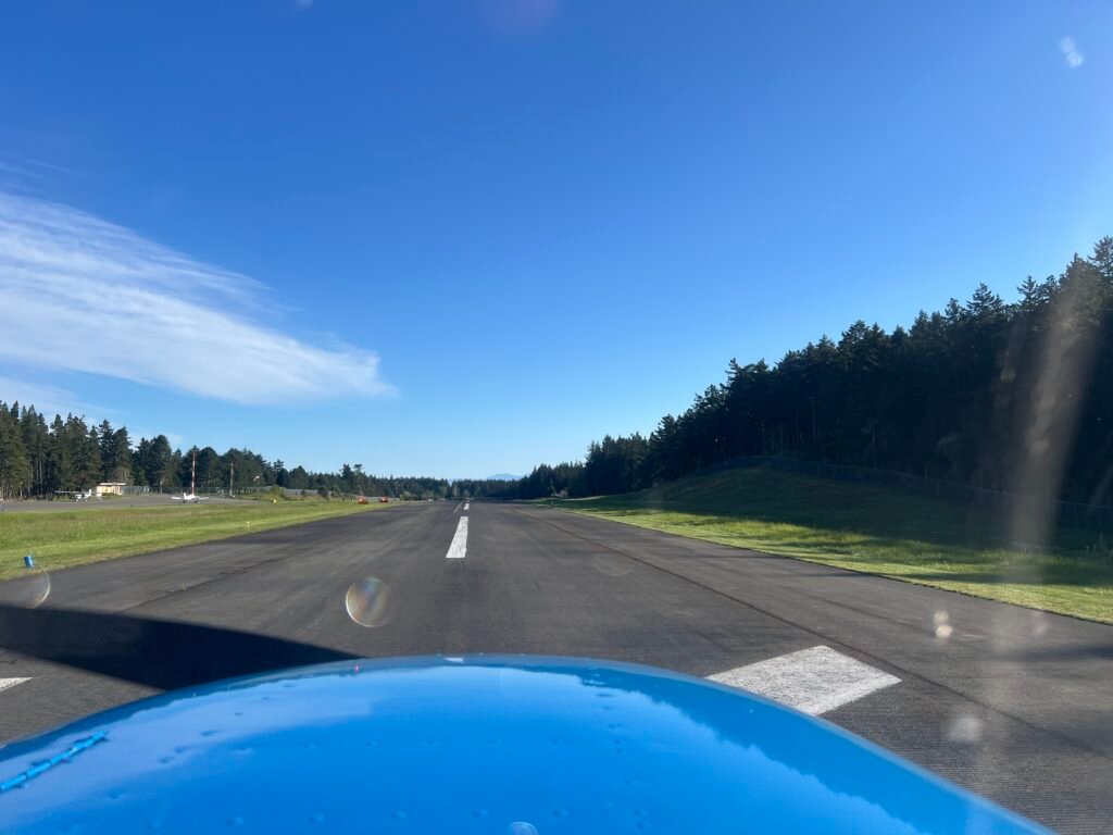
But on this day I had to get back to KAWO so I departed runway 16 – note the trees along the runway.
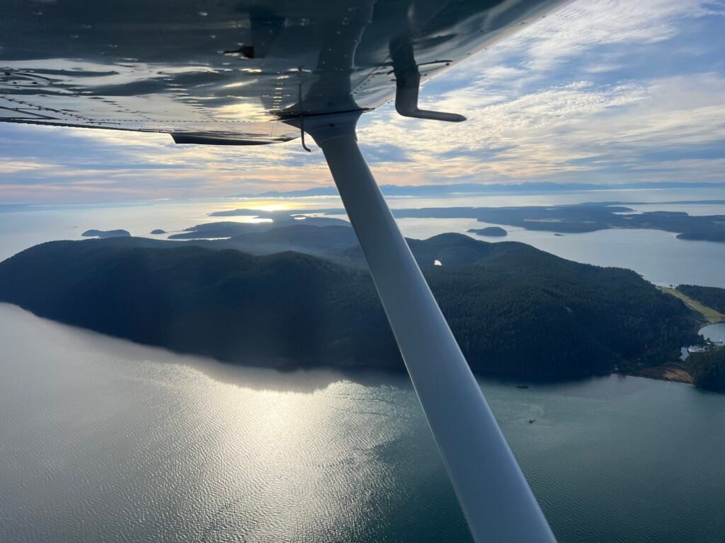
Climbing out of Lopez to the east, I crossed over Spencer Spit, a narrow finger of beach reaching out from the eastern shore, with Mt. Baker glowing on the horizon ahead, picking up the alpenglow of late afternoon. The day was almost done.
Coming Home
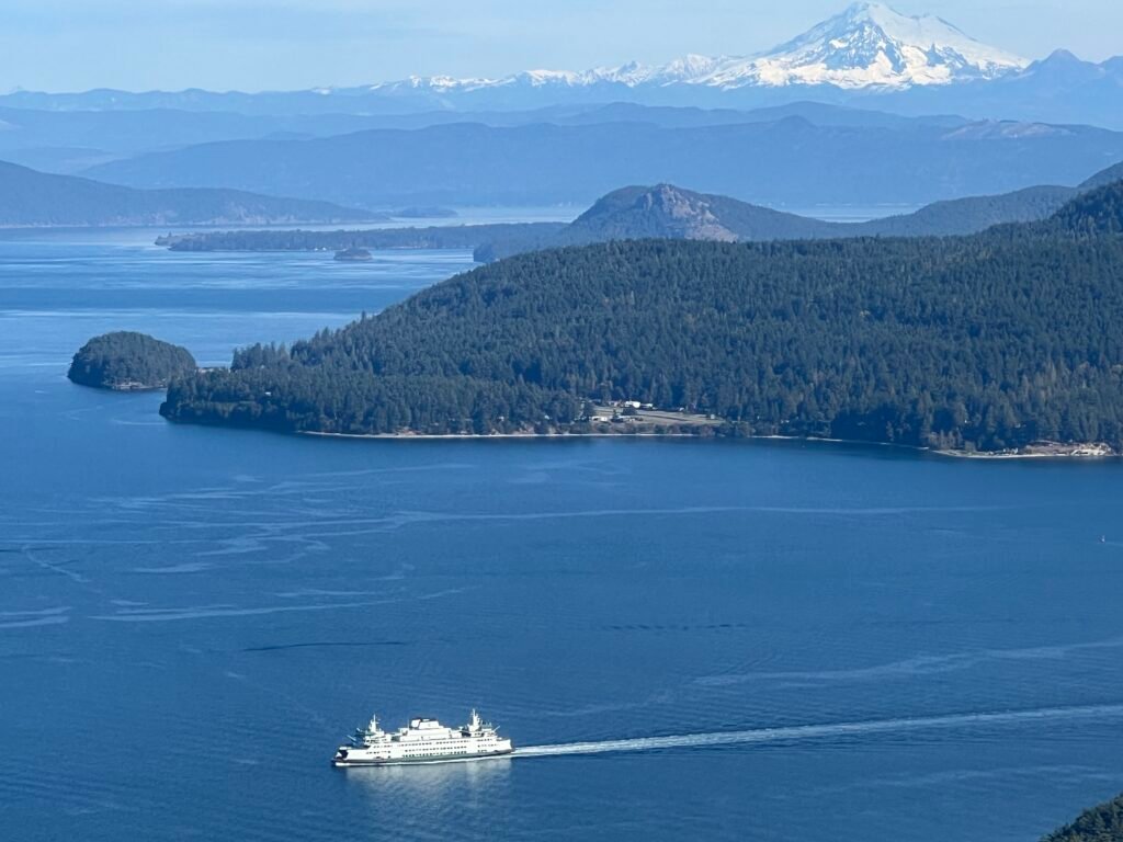
The trip back to Arlington from Lopez can go a couple of different ways depending on what I want from the leg. If I’m just trying to save time, I pick up flight following from Whidbey Approach — a quick call once I’m clear of the islands — and request a Class C transition almost directly through. They’re usually accommodating, and the direct line saves real minutes versus going around. As a bonus, the route through Whidbey’s airspace often gives me a view of military aircraft on the field or in the pattern at NAS Whidbey, which is its own kind of sightseeing if you grew up on airshow posters. There’s nothing quite like sharing the airspace with some F-18s.
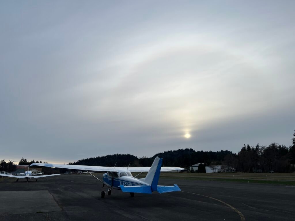
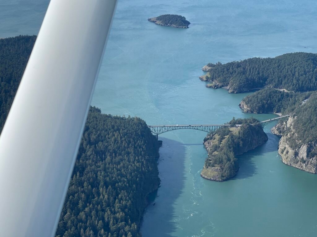
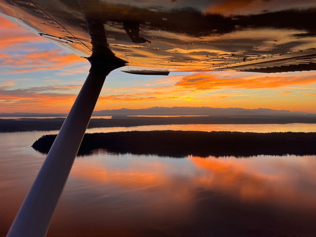
If I have more time, and I ask nicely, I’ll sometimes get cleared a little farther west to fly past Deception Pass — the dramatic gorge between Fidalgo Island and Whidbey Island, with the green-painted bridge spanning the water far below. It’s one of the most photographed pieces of geography in Washington, and seeing it from a thousand feet up on a clear evening is worth the extra few minutes when the day allows. On this trip, the sun was getting low and I wanted to be on the ground in daylight, so I took the direct routing. Whidbey cleared me through, the islands fell behind me, and Arlington came up in the windscreen.
Reflecting on the Day
There’s a thing that happens at the end of a day like this, somewhere on the leg home. The airplane is doing its job, the sky is going that particular Pacific Northwest gold-and-blue, the islands are receding behind the wing, and you find yourself thinking about what just happened. Five airports. Five completely different little worlds, separated by a few minutes of flying each. A fuel pump in Anacortes. A pilots’ lounge with a couch that’s seen better days. East Sound stretching out next to Mt. Constitution. Trees flanking a 30-foot wide strip at Roche. A pizza at Bakery San Juan. The quiet at Lopez. Sucia from above. Mt. Baker on the horizon, every time I looked East and the Cascades to the south across the Strait of Juan de Fuca.
I get to do this for a living, and on days like this I’m aware of how lucky that makes me. Not everyone can fly here. Not everyone has the time, the rating, the airplane, the weather window all line up at once. When all four do, and I’m the one in the left seat, I try to pay attention to what that actually feels like.
There’s also something the islands give back to a pilot, and it isn’t just scenery. It’s the kind of flying. Five short fields in an afternoon makes you better at short fields. A handful of overwater crossings makes you sharper about glide range and altitude management. Wind that channels and lulls and changes between airports five miles apart makes you a more thoughtful weather decision-maker. By the end of a day like this, my flying is just better than it was at breakfast. The islands teach in a way that practice-area pattern work cannot. That’s the thing I want other pilots to experience too, not because I planned the day as a lesson, but because the day is the lesson if you’re paying attention.
The runway at KAWO came up in the windscreen, the wheels touched, and Thomas rolled out the way he always does. Really useful engine. I taxied in, shut down, did the post-flight, secured the tie-downs, walked back to the car. Everything quiet now. The airplane cooling, ticking. The sun going down on another good day in the air.
If you’ve read this far and you’re a certificated pilot (at least a Sport Pilot or PPL) who’s been thinking about flying the San Juans, that’s the conversation I most enjoy having. I run a course out of Arlington called the San Juan Islands Flight Training Course that does this kind of day with you in the left seat and me in the right, working through water crossings, short-field technique, island weather, and the airspace around Whidbey, with ground instruction worked in at each stop. If that sounds like your kind of flying, get in touch.
Disclaimer: I’m a CFI/CFII, but I’m not your CFI/CFII, and nothing in this post is flight instruction. This is a personal account of how I’ve come to fly the San Juan Islands over many flights in the area, written from memory and personal experience. Every technical detail mentioned — runway dimensions, frequencies, airspace floors, traffic patterns, noise abatement guidance, identifiers, distances, anything operational — is recalled from how I’ve come to know these airports, and is not a substitute for official sources. Airport conditions, procedures, frequencies, runway data, airspace, and noise abatement guidance change. Verify everything against the current chart supplement, FAA publications, sectional charts, NOTAMs, AWOS/ATIS, and the airport operator before you fly. Pilot in command authority and responsibility for the safe conduct of any flight rests entirely with the pilot in command. If you’d like to fly the islands with me as your instructor, that’s a different conversation — see the link above.
Bryan Gmyrek is a CFI/CFII based at Arlington Municipal Airport (KAWO) in Snohomish County, Washington. Before becoming a flight instructor, he did particle physics research at Fermi National Accelerator Laboratory and worked as a software engineer in tech. He owns and operates Emerald Air LLC.
Leave a Reply