The decision came simply enough. I wanted to fly the Columbia River Gorge and get a pizza, and that morning I looked at the weather and realized I could. Light winds at Troutdale. Light winds at Hood River. Light winds at The Dalles. A high-pressure system parked far enough offshore to keep the marine layer thin, and far enough inland to keep the eastern air stable. Gap flow, the funneling of pressure-driven wind through the only sea-level break in the Cascade Range, wasn’t doing much of anything. Just a quiet day in the canyon, which is the kind of day you can’t order in advance. I had no other plans.
So I went.
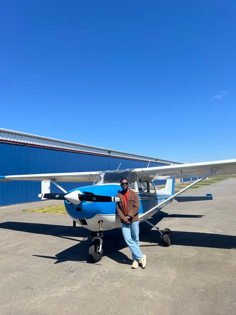
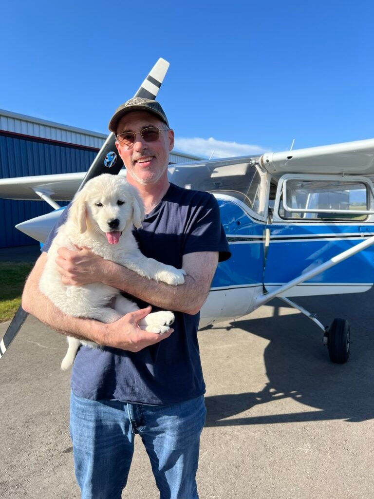
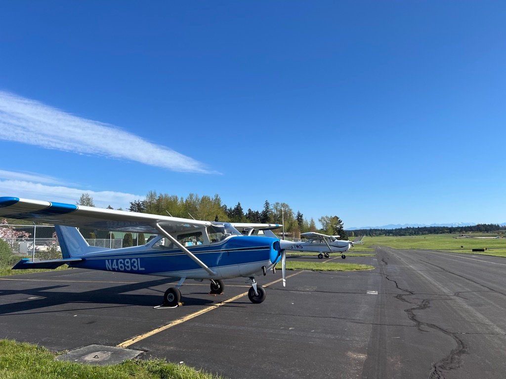
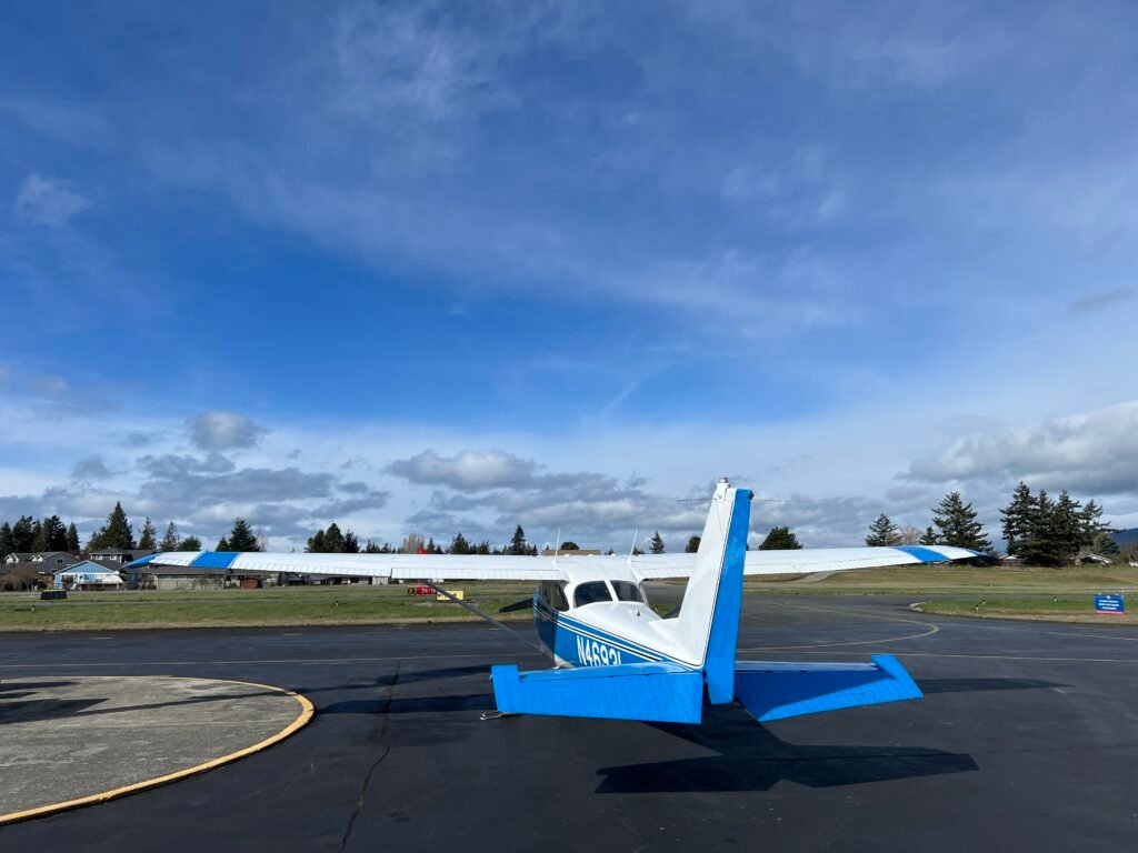
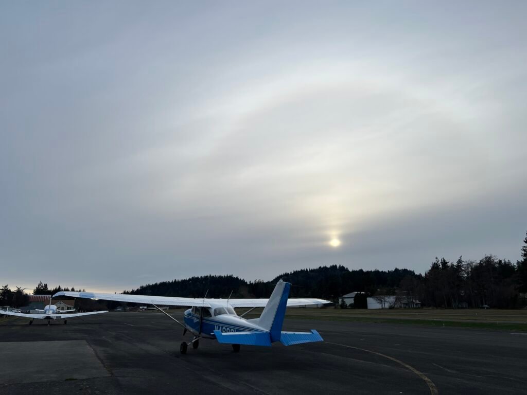
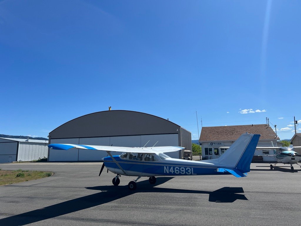
Thomas was ready. He almost always is, a 1966 Cessna 172G, sixty years old this year, and the airplane I do the bulk of my flying in. People who don’t fly tend to assume an old 172 is a starter airplane, the kind of thing you graduate from. They’re wrong about that. Thomas will hold me in the air for a few hours, as long as I’d want to fly without stopping anyway, with plenty of reserve fuel still left. The day I’m about to describe was, in his estimation, an ordinary Tuesday. It was the pilot who had to rise to it.
The runup went the way runups go. Magnetos in limits, carb heat on / rpm drops, G5s aligned and steady, mixture full rich for sea level. I called clear on the CTAF, lifted off Runway 34, and turned south.
Southbound on the West Side of the Bravo
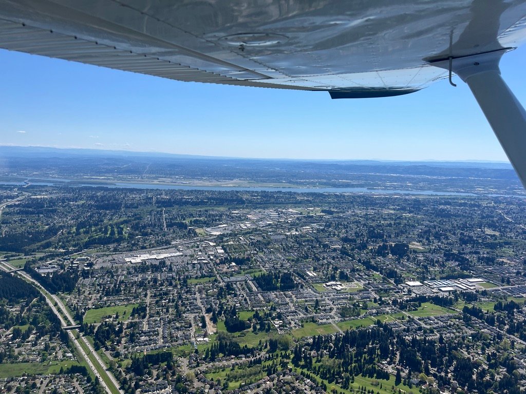
I climbed to three thousand feet and held it there. There is a discipline to flying this corridor that I have come to think of as a kind of courtesy: the airliners belong up high, where they can do their work efficiently, and the small airplanes belong down low, where we can see what we came to see. Three thousand puts you under most of the Seattle Class B shelves and over most of the surface terrain, which is to say it puts you where you ought to be, out of everyone’s way, including your own.
Flight following should not be considered optional for this routing. The west side of the Bravo is a fence-line, not a buffer, and the Delta airspaces, Boeing Field, Renton, Bremerton, Tacoma Narrows, Olympia, McChord, are scattered along it like beads on a string. You want traffic calls. You want to know who else is in your altitude block and who is closing on you from behind. And you want the gentle institutional memory of an ATC controller who can tell you that the airspace you’re about to fly into is hot today.
But flight following can disappear. The Pacific Northwest is full of terrain that swallows VHF, and Seattle Center’s coverage at three thousand feet is not the blanket it is at ten. You can be in radar contact one minute and a memory the next. Which is why, and I cannot stress this enough, I had a VFR flight plan filed for the entire route. A filed flight plan is what stands between you and a lot of empty country if something goes wrong and the radar trail stops. It costs nothing and with electronic flight bags its easier than ever. There is no excuse not to.
I tried to stay near the edge of the water for the view, but the shelves of the Bravo step down toward the Sound, so I fly a little farther west than I’d really like to.
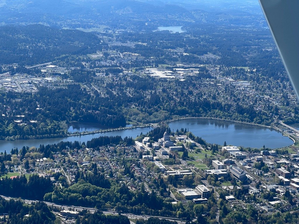
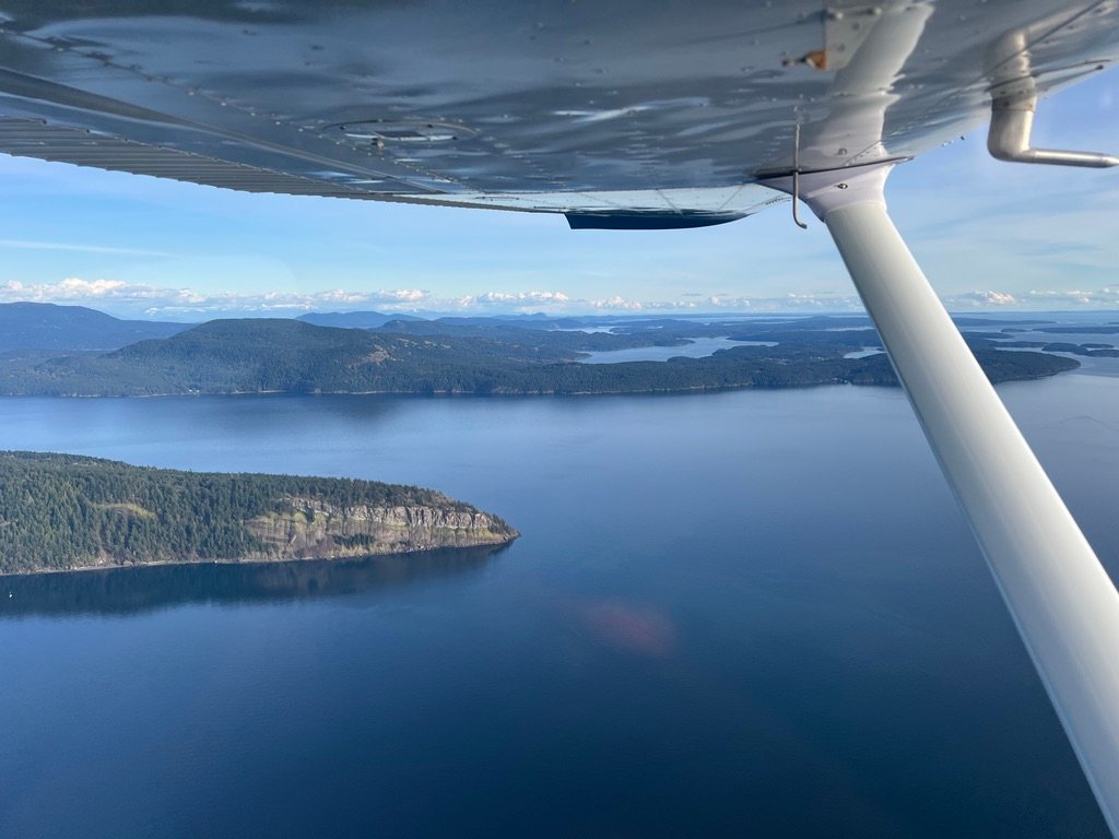
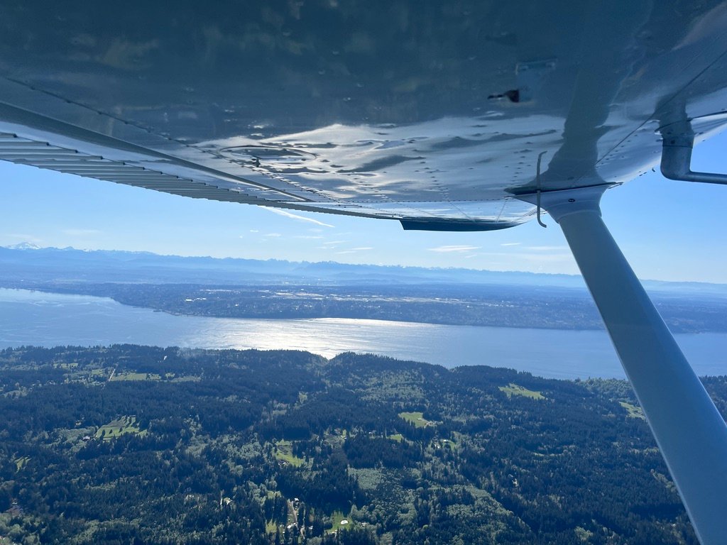
Past Tacoma the city receded behind me and the air turned plainly rural. Olympia slid by on my right, the dome of the capitol pale in the morning sun.
And then Rainier.
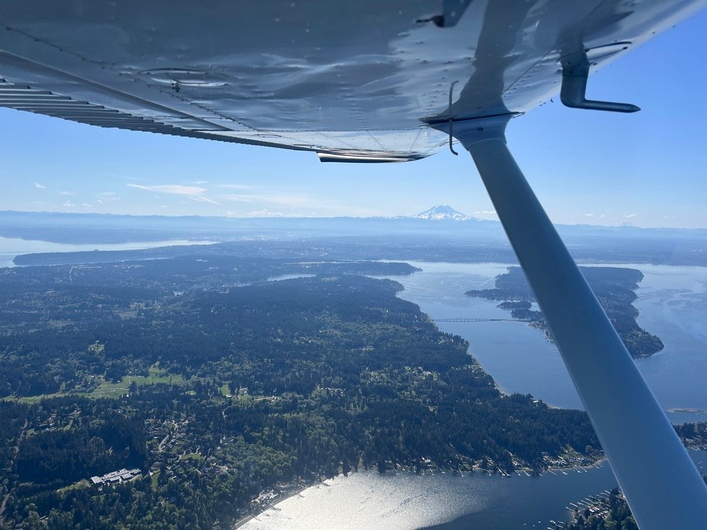
Even after years of living under it I do not get used to Mount Rainier. It rises 14,410 feet out of country that is otherwise hills and inlets, and from a Cessna at three thousand feet it does not so much loom as occupy a chunk of the sky that you assumed belonged to something else. You learn to navigate by it on clear days the way sailors must have learned to navigate by certain stars.
The Long Slow Descent of the Lowlands
Past Olympia the country opens up. The terrain south of the Puget basin is gentler than the country east of the Cascades, and the small airports cluster in a way that makes them easy to track on the sectional: Chehalis, Toledo, Kelso, all of them within a half-hour’s flying of one another, all of them with their own personalities.
Chehalis-Centralia (KCLS) came up first. I had no reason to land there and didn’t, but I dialed up their CTAF and listened for traffic anyway. Then Toledo. Be mindful of Toledo. Ed Carson Memorial / South Lewis County Airport (KTDO) is home to Skydive Toledo, one of the longest continuously running parachute centers in the country, and on a sunny day they will be putting bodies out of an airplane somewhere between three thousand and twelve thousand feet. I monitor their CTAF whenever I’m within ten miles, ask if anyone is jumping out of perfectly good airplanes today, and I keep my head on a swivel.
I have stopped at Toledo for fuel before, and I will again. The runway is 4,479 feet, long for a small-town airport, and the fuel is reasonably priced for the region, which is a combination that makes it a useful waypoint for a lot of pilots heading south out of the Puget Sound basin. On this trip, though, Thomas had plenty in his tanks and a longer day ahead of him, and I had set my route to fuel at The Dalles instead.
Kelso and the Two Rivers
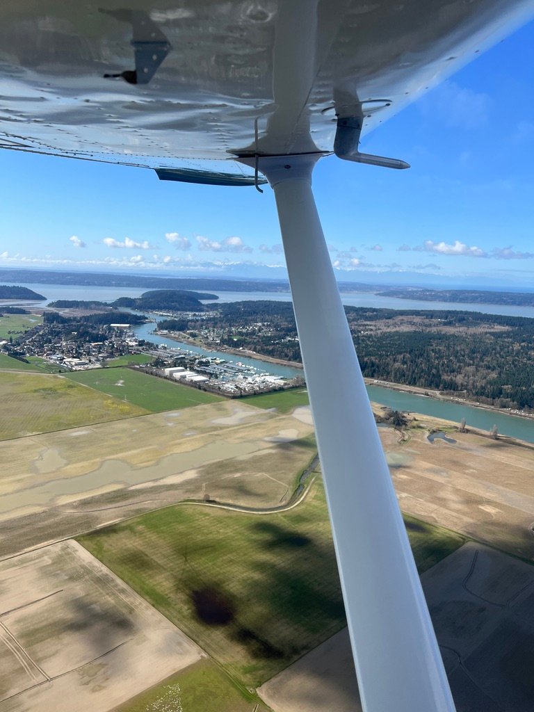
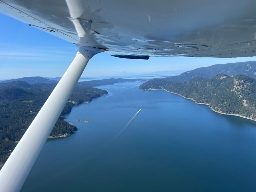
South of Toledo the country falls away toward Kelso, and I let Thomas come down with it. From three thousand to fifteen hundred feet over the course of about ten minutes, the kind of slow controlled descent that gives you time to look at things on the way down. The Cowlitz River runs roughly north-south through this valley, and at fifteen hundred feet it stops being a blue line on a chart and starts being a river, a real one, with bends and bars and the particular slow brown of a Pacific Northwest tributary in late spring.
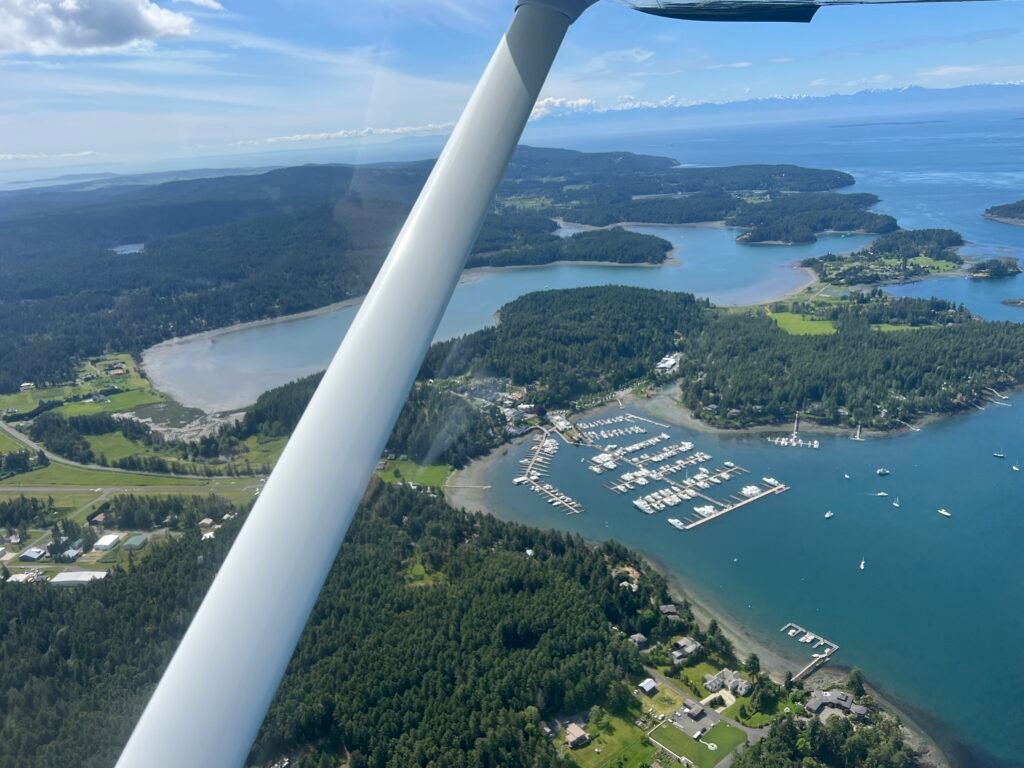
Southwest Washington Regional (KKLS) sits a couple of miles north of the confluence with the Columbia. It is one of those airports that a stranger could miss on a sectional and a local could navigate to with their eyes closed. I picked up its CTAF on 122.8 and listened. There were two or three pilots in the pattern or coming or going, and I made a call announcing my position and intentions: I was flying over the field at fifteen hundred for the river view, not landing, and I would clear south. Calling out is the small courtesy that keeps everyone safe in this airspace. It costs nothing. Doing it well is its own minor pleasure.
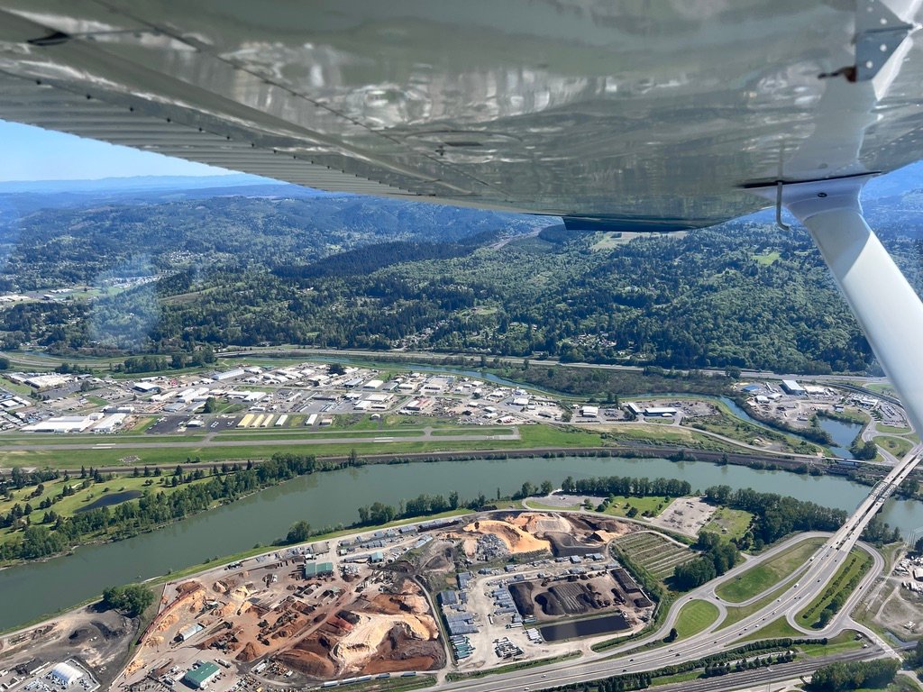
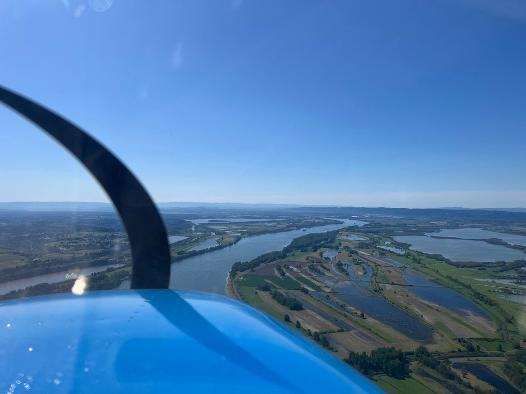
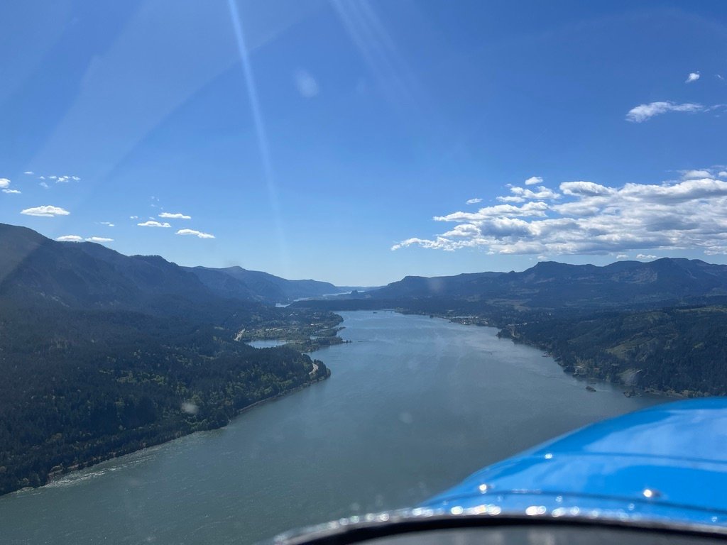
And then the confluence.
The Cowlitz curls in from the north, narrower and darker than what it joins. The Columbia stretches east and west wider than I had a name for, more channel than river. The view west is a temptation I know well; I have followed it many times out toward Astoria and the bar, where the river surrenders itself to the Pacific in the only way a river that size can. But not today. Today I turned south, toward Portland and Troutdale, and let the Columbia carry me toward the Gorge.
South to Portland
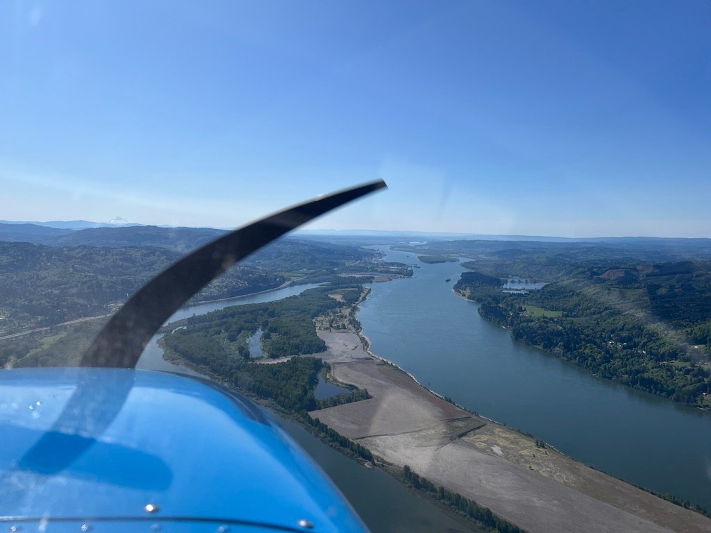
I pointed the airplane south and followed the river. The Columbia is beautiful the whole way down. It widens, it narrows, it bends through islands and around bluffs, and for forty miles between Kelso and Portland it carries you straight to the city, no GPS required, just the dark seam of water between two states. Mount St. Helens off to the east kept its distance, white-topped and patient. I waved at it the way you wave at a neighbor.
Scappoose (KSPB) came up on the west bank, a 5,100-foot strip tucked between the river and US 30. It’s a popular Saturday airport — the kind of place where the CTAF stays busy and the pattern has a half-dozen airplanes in it on any decent afternoon. I made my position call, kept the river off my left wing, and turned my attention to the Portland Class C, which was about to become the morning’s main piece of work.
The Portland Class C is nothing to trifle with, and the Portland Terminal Area Chart treats it with an unusual amount of seriousness for a Charlie. There are published VFR transition routes through and around it, the chart notes specify ATC authorization at or below 4,000 MSL, and some pilots have started informally describing the airspace as Class-B-flavored. Whether that comparison holds up to scrutiny is its own debate. The practical point is that a pilot transitioning the Portland area east into the Gorge should treat the Class C as the busy airspace it is, and act accordingly.
For my direction of flight, eastbound, joining the Gorge from the north, the relevant published route was the Thorns, which runs north-south past Crown Point at or below 4,500 MSL, entirely outside the eastern boundary of the Class C. Two things about the Thorns route are worth knowing. First, it does not enter the Class C, which means a pilot can fly the corridor without strictly needing a clearance, though calling Portland Approach is still the right move both for traffic awareness and because the chart asks you to. Second, the route’s name is a small linguistic accident: Crown Point was historically known as Thor’s Heights, well before the Vista House and the Columbia River Highway gave it the name it carries now.
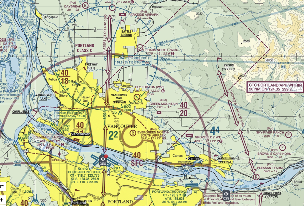
I checked in with Portland Approach as I came south, identified myself, stated my intentions, VFR, southbound, joining the Gorge eastbound, using the Thorns transition, and the controller acknowledged me on flight following. Even though the route stays outside the Class C and you can argue the radio call isn’t strictly required, the safety case for being on the radio with PDX Approach in this airspace is overwhelming: there is a lot of jet traffic in the vicinity, the controllers are watching everything on radar, and a friendly check-in costs you nothing. I rode the Thorns corridor down the east side of the Class C, watched the magenta line of the Charlie slide past on my right wing, and held my altitude until I was certain I was clear of both the Charlie and Troutdale’s Class D below.
Then I descended into the Gorge, over the Columbia, with the river to lead me east.
Troutdale, and the Edge of the Class D
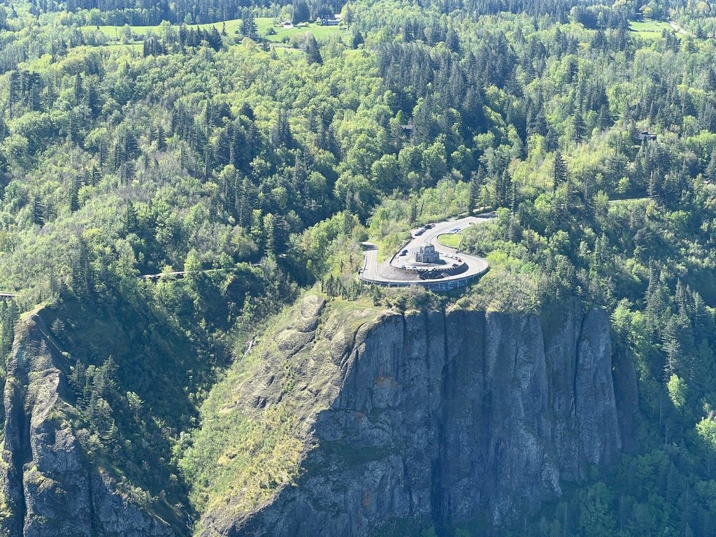
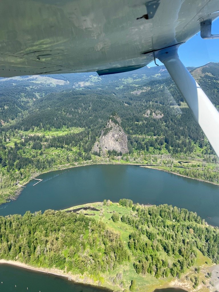
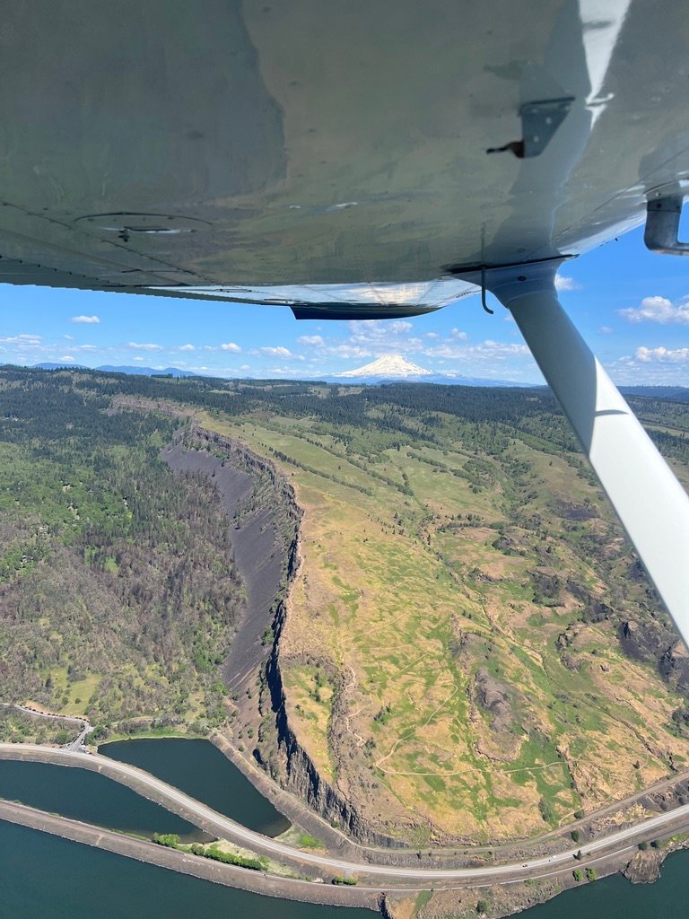
One piece of airspace to be aware of here is Troutdale’s Class D, a small but assertive cylinder that rises to 2,500 feet MSL and sits directly across the eastern Columbia just before the Gorge swallows the river whole. On the Thorns transition I pass East of it, and start descending lower so I can get a good look at The Vista House to the East.
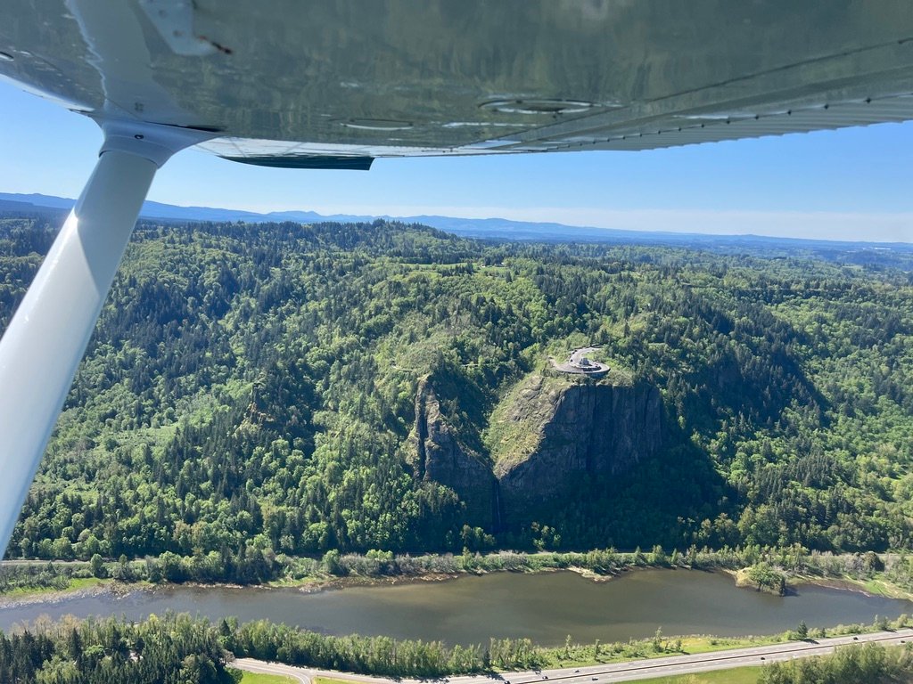
The stone observatory sits on the edge of a basalt cliff 733 feet above the Columbia, dedicated in 1918 as a memorial to the Oregon pioneers and as a comfort station for travelers on the new Columbia River Highway. From the air it is unmistakable, a small octagonal building on a promontory that pushes out into nothing, and I passed close enough to see its green-tiled roof clearly but far enough off the cliff to keep margin. The terrain east of Crown Point falls quickly into the Gorge proper, and the air at the cliff edge can do strange things in even modest winds. On this day it was glassy and I had Thomas trimmed for cruise. Even so, you stay a respectful distance from features like that.
A few minutes to the east, the falls began.
Multnomah Falls, 620 feet, two-tiered, the tallest waterfall in Oregon, pours out of the rim of the Gorge on the Oregon side like something staged. From the air, the geometry of the falls is something you cannot see from the ground. You look down and see the whole drop at once: the upper plunge into the bowl, the Benson Bridge crossing the gap between, the lower fall pouring out into the streambed below.
Into the Gorge
After Multnomah Falls the Gorge opens up in earnest. The walls climb on both sides, the river widens, and the country I was flying through stopped being “near Portland” and started being its own place. There is a particular discipline to flying the Gorge, stay on the right side of the corridor, keep airspeed slow enough to see and to maneuver, hold altitude tight, watch the walls. There was no wind to speak of. On a day with strong gap flow this canyon turns into a wind tunnel, with mechanical turbulence pouring off both walls and rotor shaping up over the ridges. On this day it was glass.
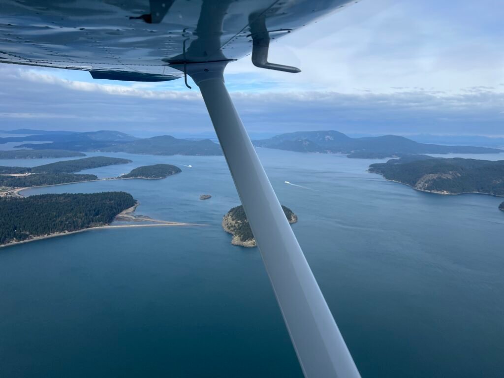
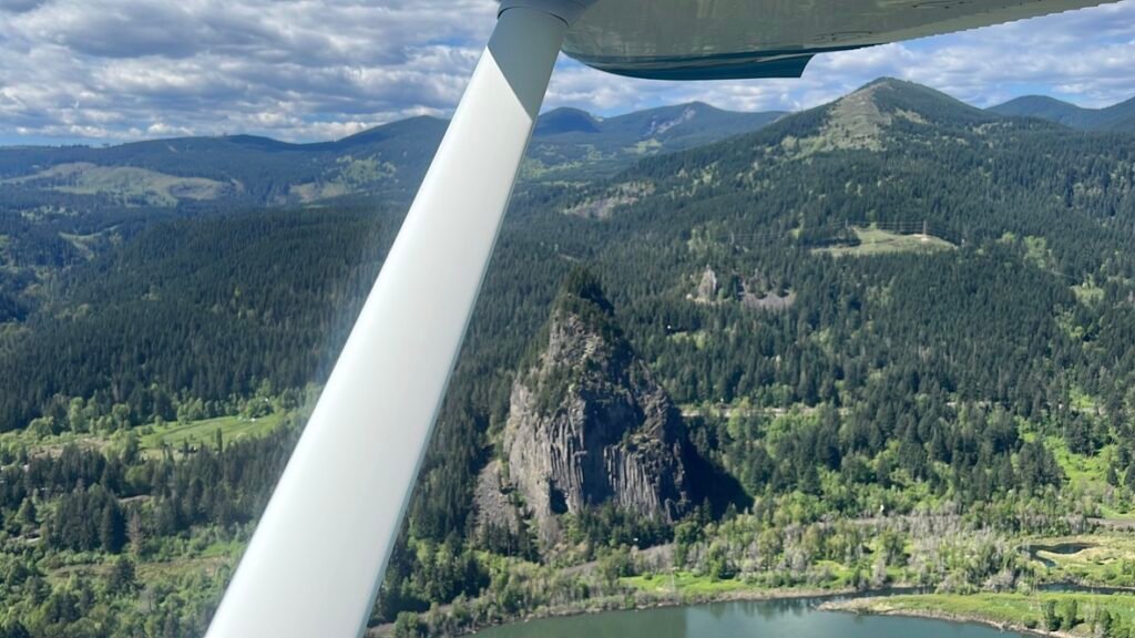
Beacon Rock came up on the Washington side, eight-hundred-and-forty-eight feet of basalt monolith standing alone at the river’s edge.
Lewis and Clark named it in 1805. The Chinook called it Che-che-op-tin — “the navel of the world.” In the early 1900s the Army Corps of Engineers wanted to blast it into rubble for jetty construction; Charles Ladd refused, and in 1915 sold the monolith to Henry J. Biddle for one dollar with a preservation clause in the deed. A monolith is still there because two private citizens decided, decades apart, that it ought to be. That’s a kind of patriotism I can get behind.
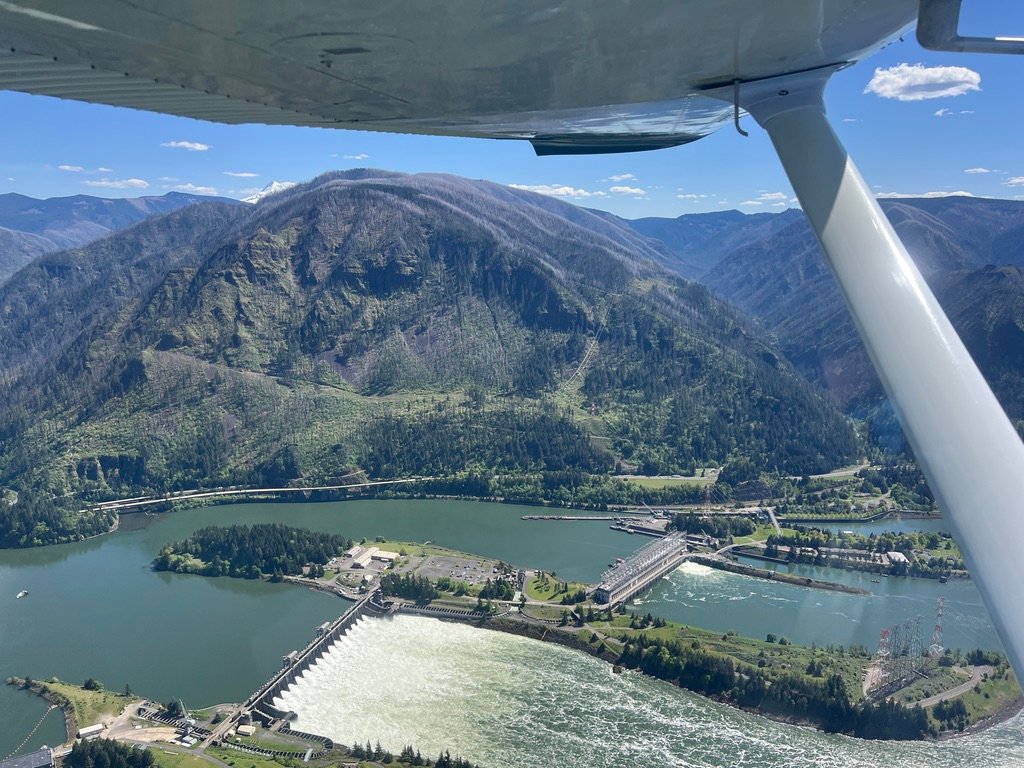
A few minutes later, Bonneville Dam.
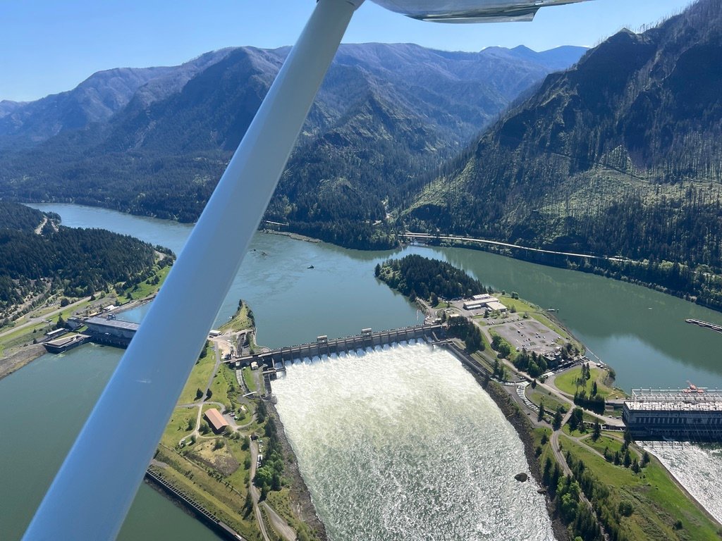
The dam is unmistakable from the air, concrete spillways, the green of the slack water above, the long line of the powerlines crossing the river to about 440 feet MSL. Stay well above those wires. I made a point of noticing the towers on both banks and tracking my altitude carefully. The Gorge teaches altitude discipline by necessity.
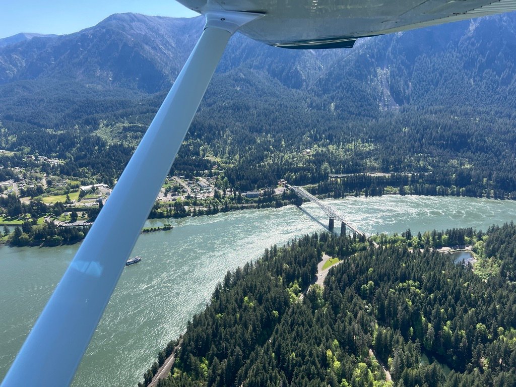
The Bridge of the Gods came next, a steel cantilever truss spanning the river at Cascade Locks, four miles upstream of Bonneville Dam. The Pacific Crest Trail crosses the Columbia on this bridge, at what is the lowest elevation point on the entire 2,653-mile route. There is something quietly moving about flying over a bridge that a thru-hiker walks across after a couple thousand miles of trail. We were both moving through the same place at very different speeds, on very different errands.
Cascade Locks State Airport (KCZK) slid past below me on the south bank. It is one of the warning airports in the Oregon state system, an 1,800-foot strip with trees on three sides and a published note about extreme low-level turbulence in crosswinds. I treat it as a precautionary option, not a destination. On this day, with the air calm and Hood River and The Dalles open ahead of me, I had no need of it. But I noticed it. You always notice it.
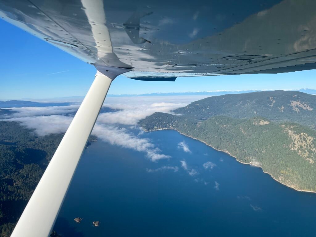
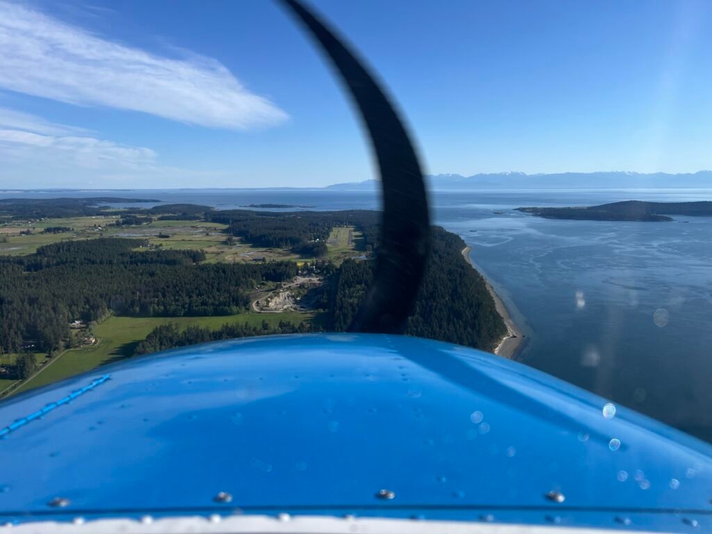
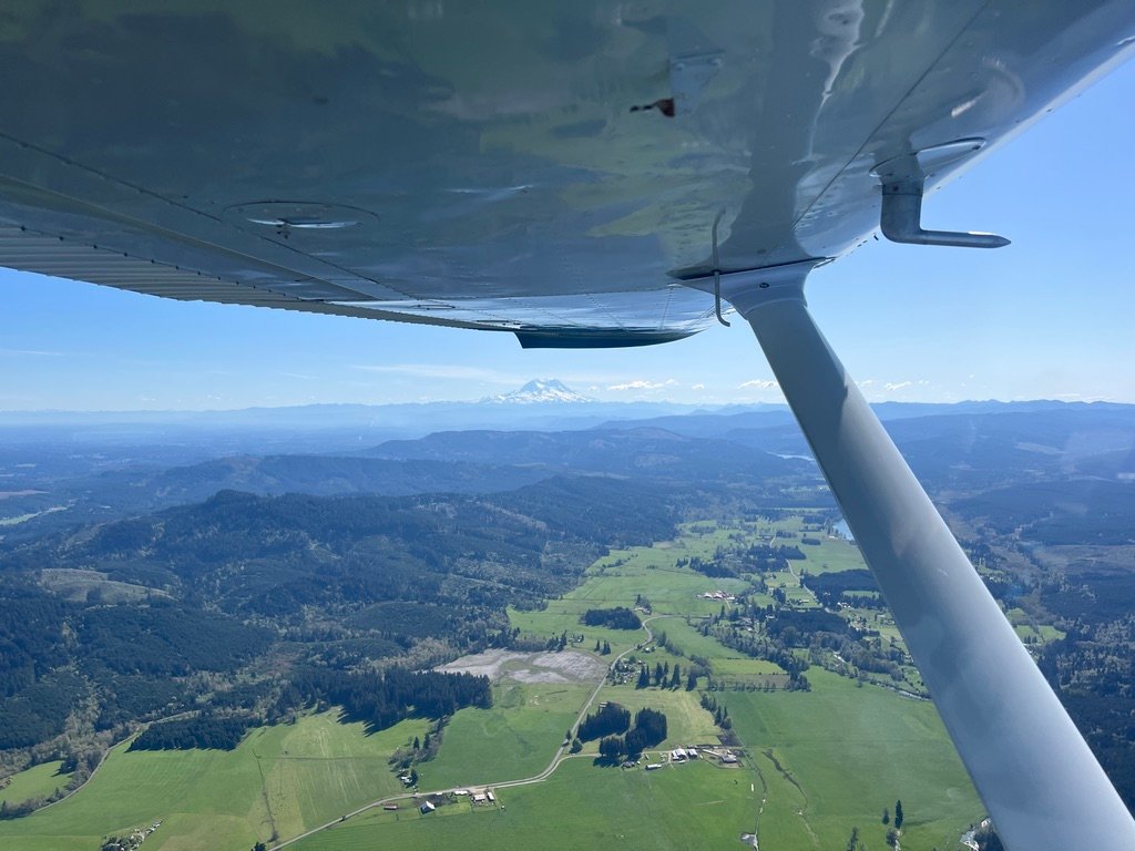
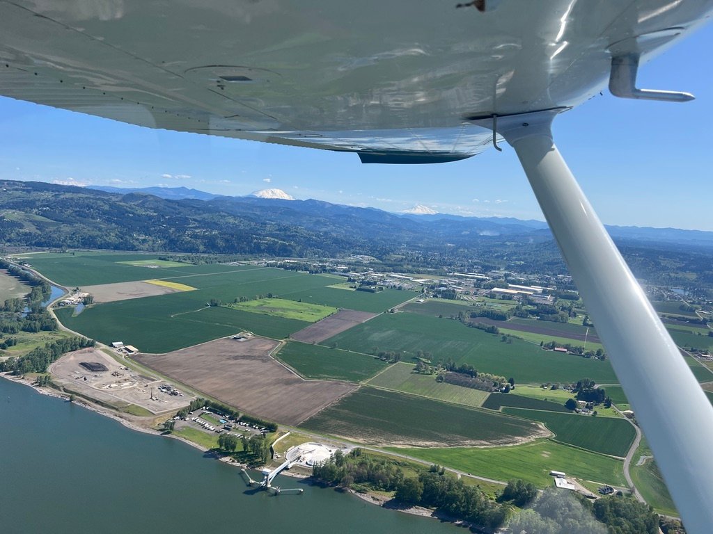
The country east of Cascade Locks transitions, slowly and then quickly. The rainforest gives way to oak savannah, the basalt walls pull back, and the river opens out into a corridor wide enough that you can finally see the mountains. To the north, Mount Adams, 12,281 feet of stratovolcano, white and serene above the Washington plateau.
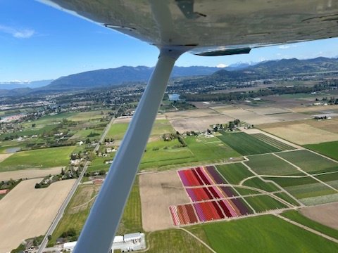
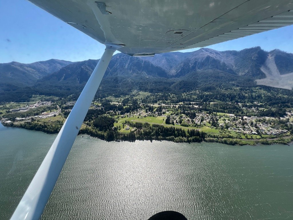
To the south, Mount Hood, 11,249 feet, sharper-edged, more glaciated, with the Hood River valley spreading green at its feet.
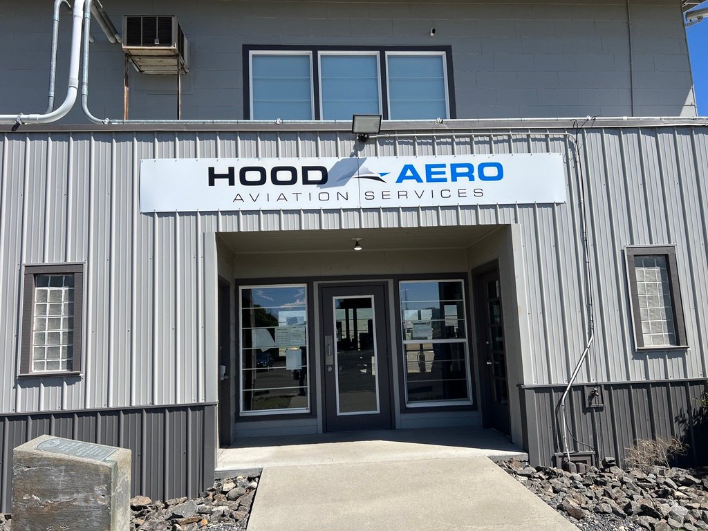
Two volcanoes on opposite sides of a single canyon, neither one closer to me than the other. It is a kind of geographic luck to be flown between them. The Hood River FBO is called Hood Aero. Sitting in the cockpit of a Cessna with both peaks in sight, I understood the name.
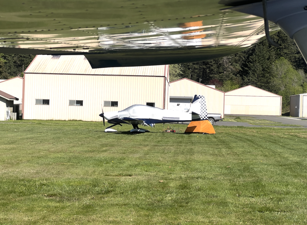
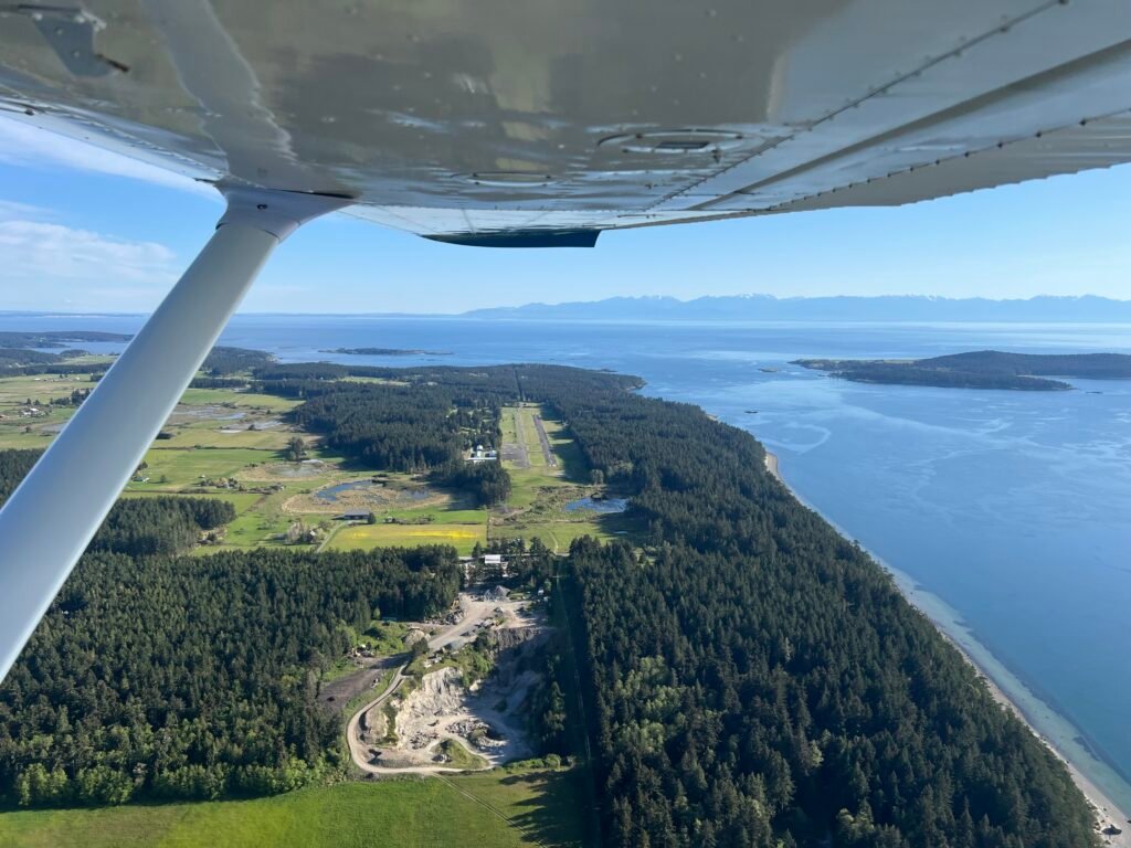
I passed Ken Jernstedt Airfield (4S2) on the south bank without landing. There is value in flying past an airport you intend to visit, in noting how it looks from the air with no particular pressure attached, so that when you do come back the picture is already familiar. I made the plan in the cockpit. Fuel and pizza in The Dalles, then back to Hood River on the way home.
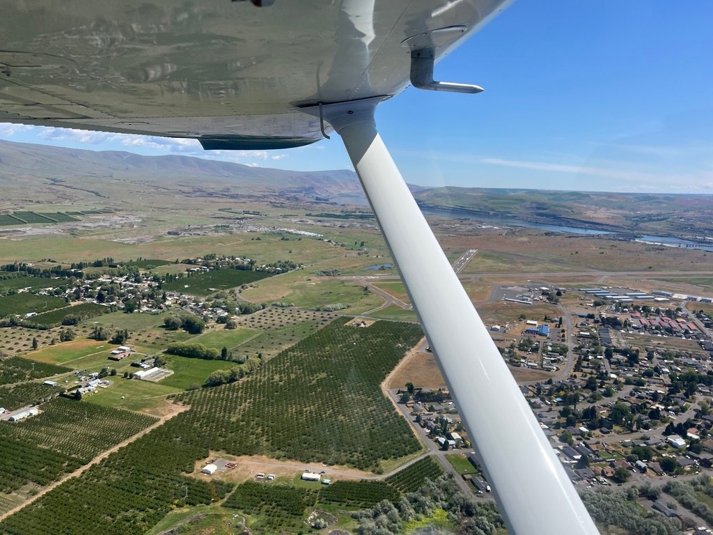
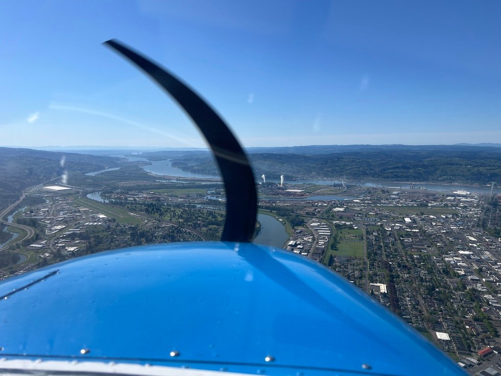
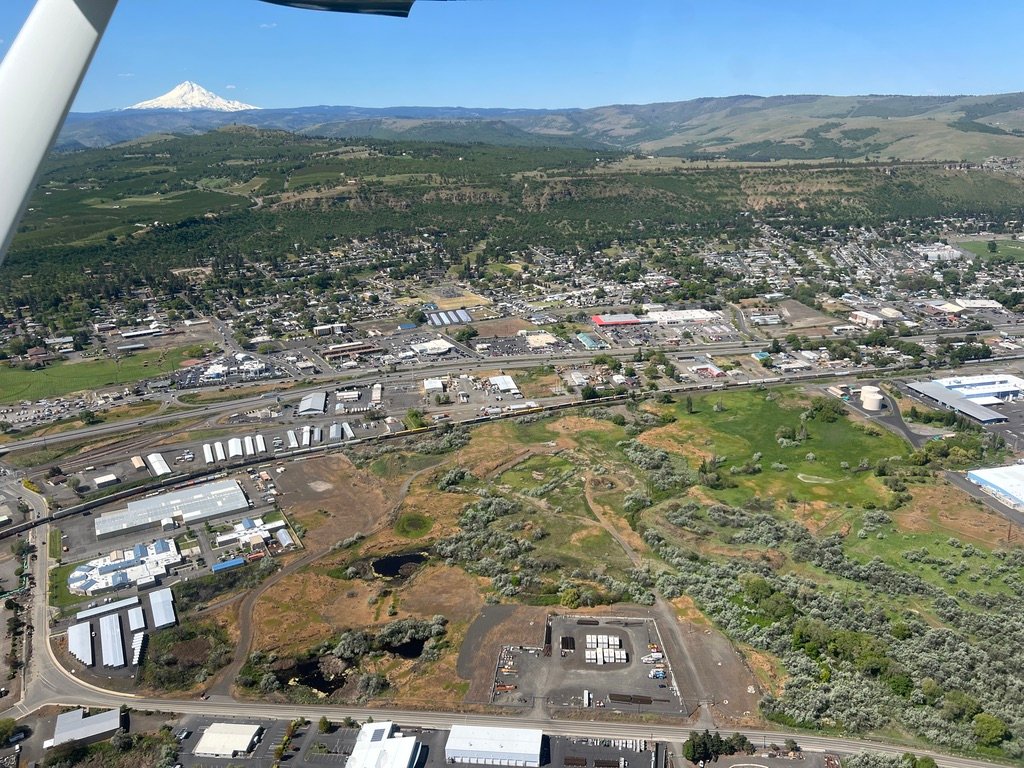
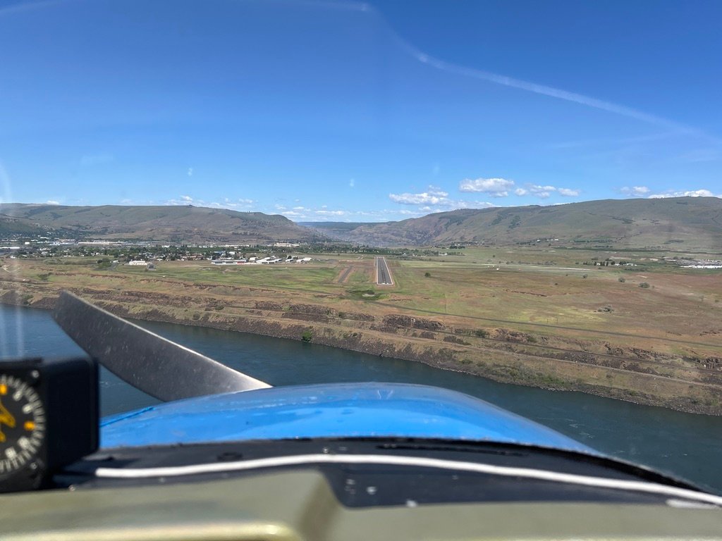
East of Hood River the country opens further. The Gorge is still the Gorge, basalt and river, but the walls have softened and the eastern dryness shows itself: brown hillsides, ponderosa pines giving way to scrub, the long agricultural fields of the Klickitat plateau on the Washington side. The Dalles Dam came up on the river, and beyond it the runway of Columbia Gorge Regional shimmered in the afternoon sun.
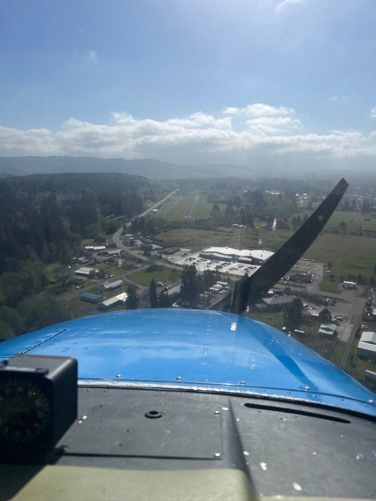
Landing at The Dalles
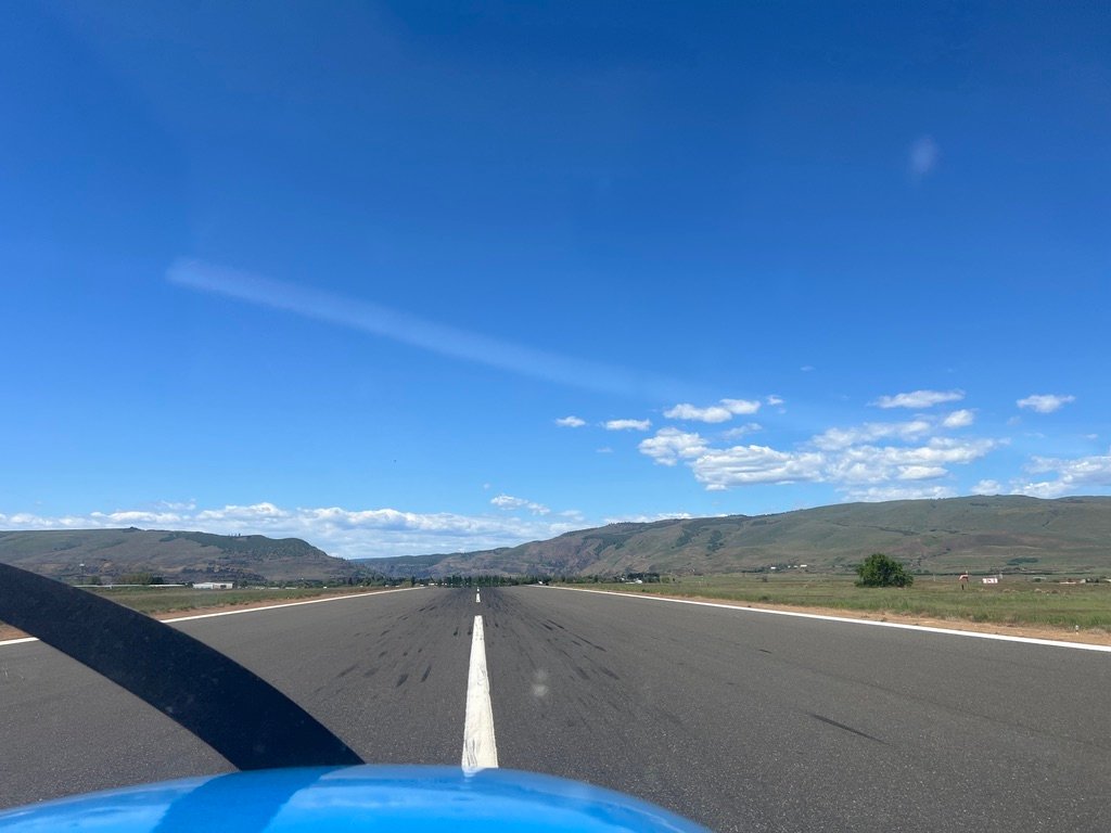
I had been monitoring the AWOS at KDLS and making position calls on the CTAF. The wind was light and the field was quiet. As the Gorge walls gave way I came out northwest of the airport, made another call, and a friendly local pilot’s voice came back: “Calm winds, anyone can use any runway, but most of us like 31.” This is the kind of exchange that small towered and untowered fields run on. Not the strict choreography of a Class C, but the older, more conversational discipline of pilots talking to pilots in the same patch of sky. I thanked him, set up for a forty-five to the downwind for runway 31, and brought Thomas around for the landing.
The 31 final at The Dalles puts the bridge on my right and the Columbia river below me, but I try not to get distracted because its time to focus on a stabilized approach. The runway is 5,097 feet long, which is plenty of asphalt for a Cessna 172. I touched down, rolled out, and took the left taxiway toward the FBO.
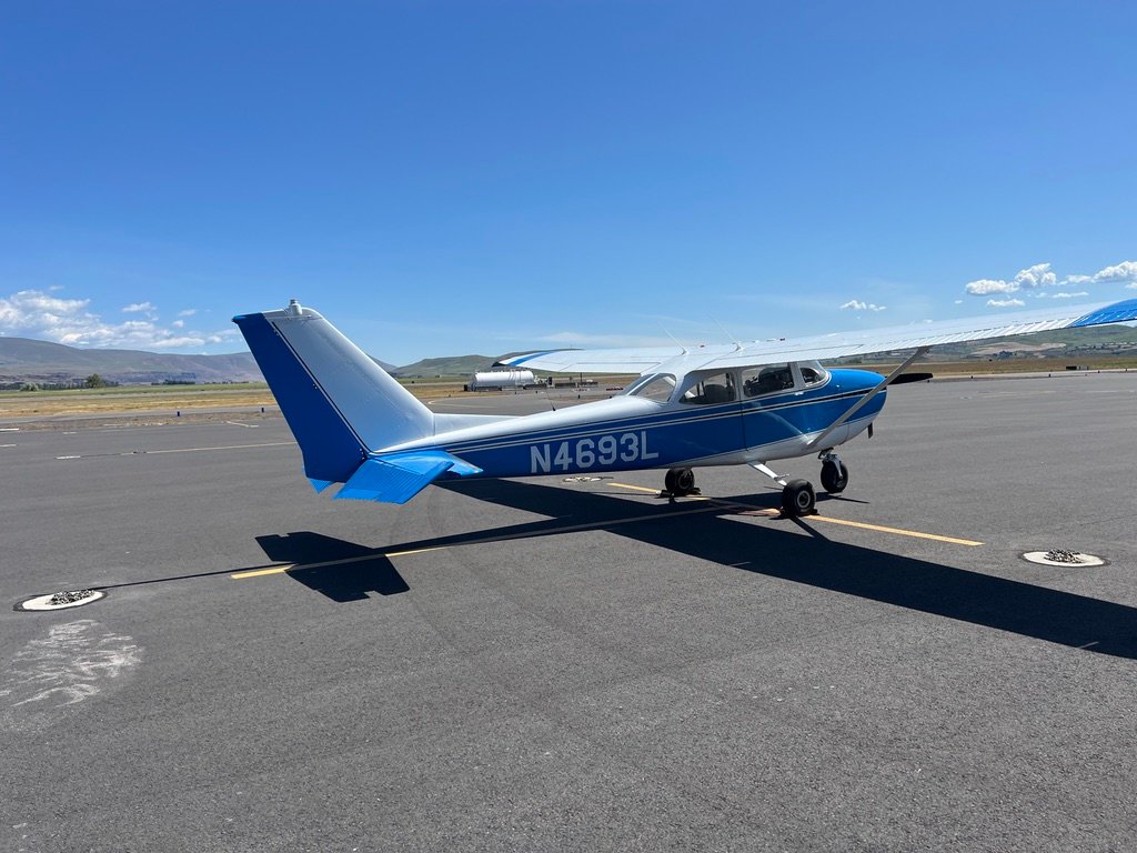
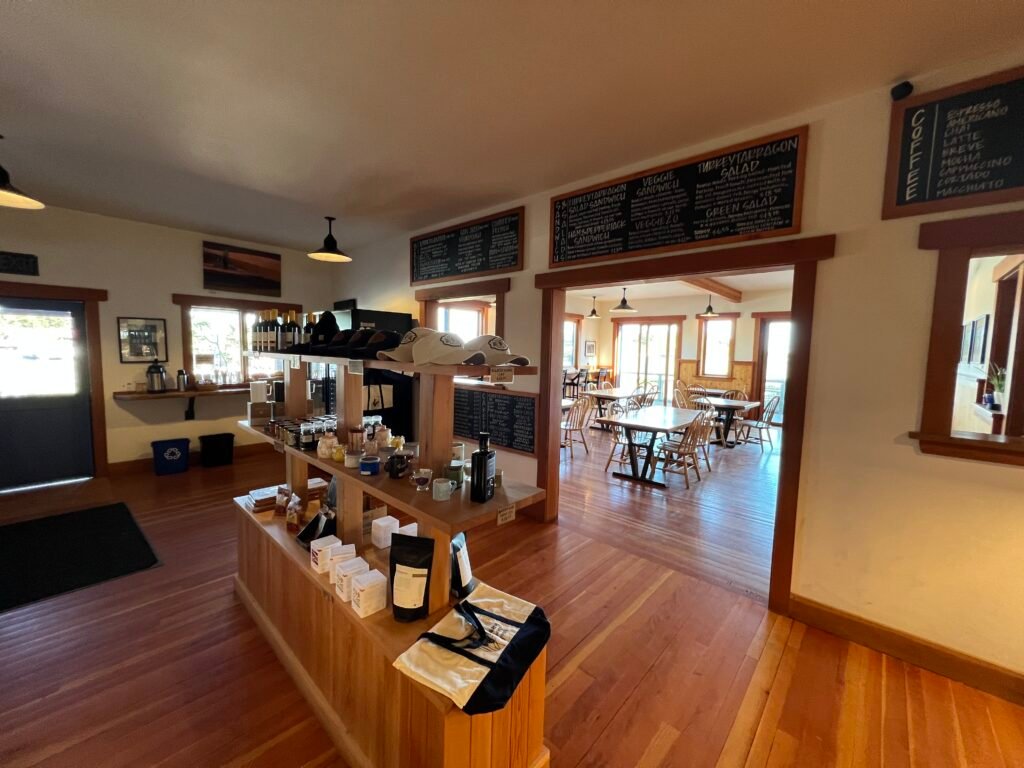
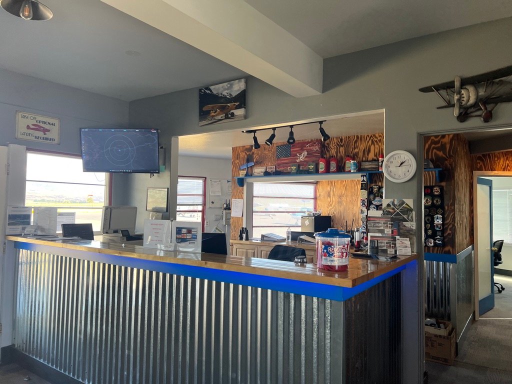
Hood Aero. Same name, same operator as the FBO at Hood River, two airports, one company, both branded after the mountain that dominates the southern sky from both fields. The pilot’s lounge was clean and well-kept, the kind of small-airport amenity that you remember not because it is spectacular but because somebody clearly cares about it. I asked about the Fly Washington Passport, and the gentleman behind the counter handed me the stamp. It took me a minute to find the right page, but once I did the stamp left a satisfying inked impression.
Here is where the geography pays a small bonus. Columbia Gorge Regional, despite being called The Dalles Municipal in some places, is not actually in Oregon. The airport sits in Dallesport, Washington, in Klickitat County, on the north bank of the Columbia.
The city of The Dalles, Oregon, owns it, and Klickitat County co-operates it under a partnership that’s existed for decades. It is the kind of cross-state municipal arrangement that makes more sense the longer you think about it. To my mind it was clarifying: the Washington passport stamp made perfect sense even though my mental map had The Dalles filed under Oregon. I was still in Washington, just barely, and I would only become an Oregonian by driving across the bridge.
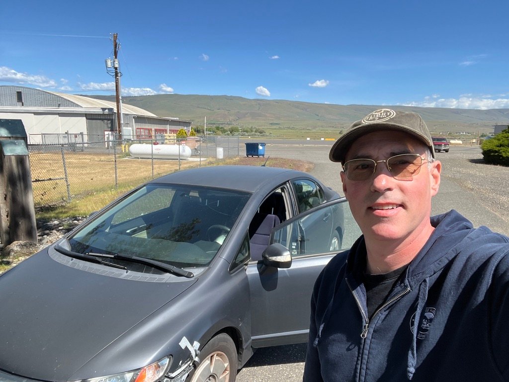
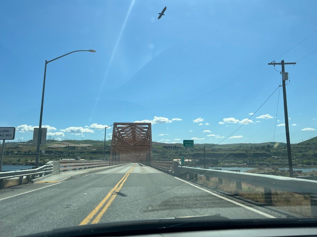
I picked up the crew car. A short drive south, across the I-84 bridge over the Columbia, and I was officially in Oregon.
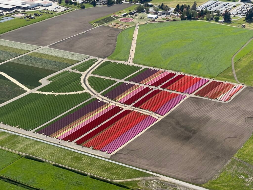
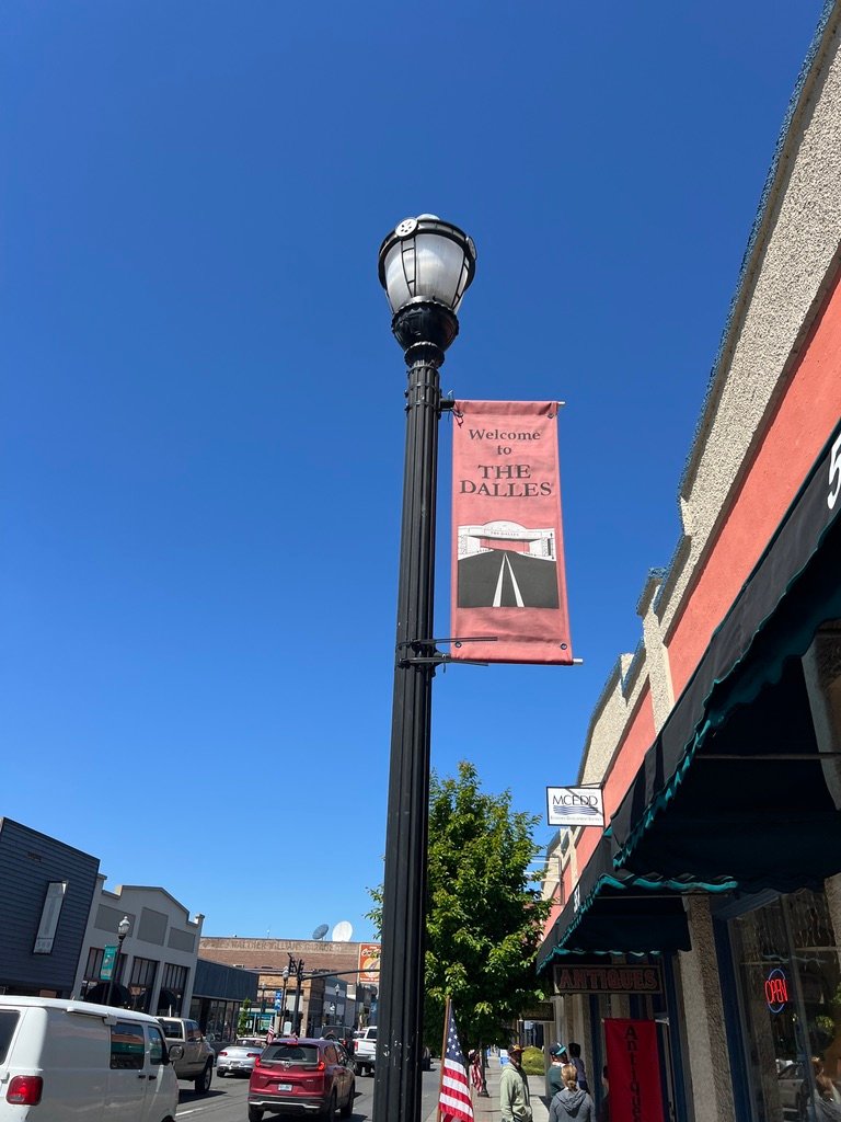
The town was vibrant. The Northwest Cherry Festival was in full swing, clearly the social anchor of the town’s spring. Carnival rides at Lewis & Clark Festival Park, music spilling out of pubs, vendors set up along the closed-off streets. Mothers chasing toddlers. Young couples eating funnel cake. Older folks parked in lawn chairs watching the whole show go by. A piece of small-town America with the volume turned up, and a kind of generous, uncomplicated public happiness that is harder and harder to find. The Dalles is the largest sweet cherry producer per capita in the country, and the festival is, ostensibly, a celebration of the cherries. But like all such festivals it is really a celebration of being able to gather, and of having something specific worth gathering around.
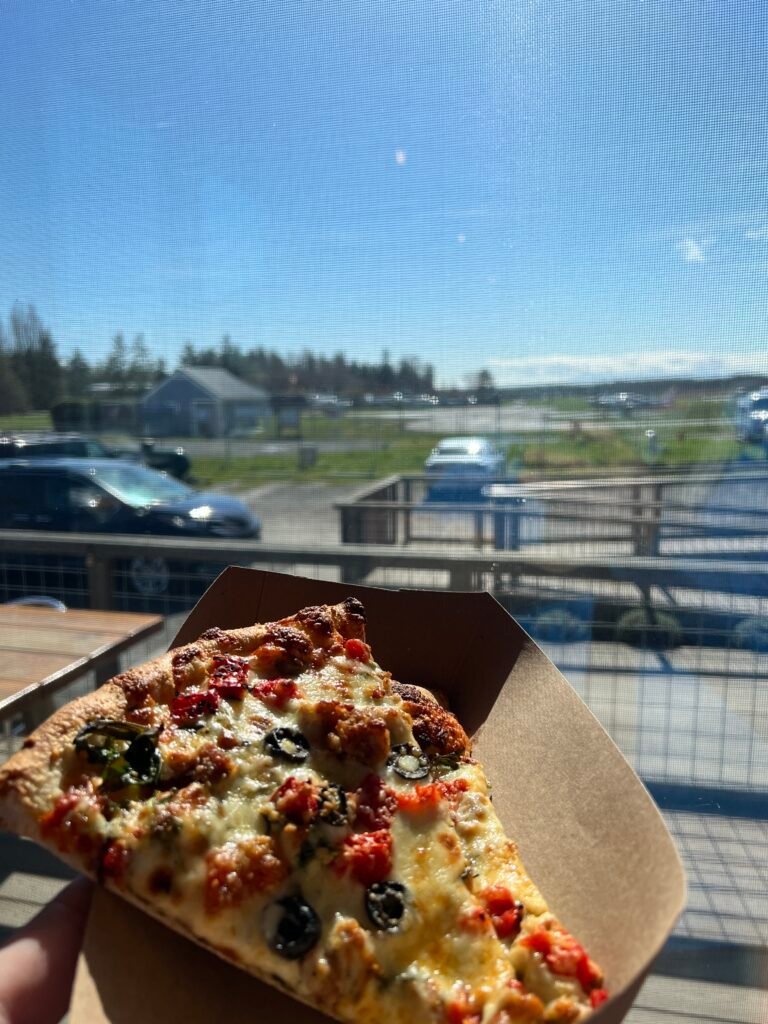
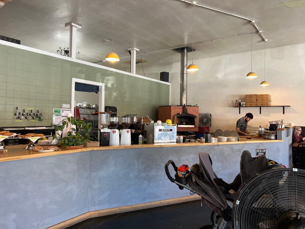
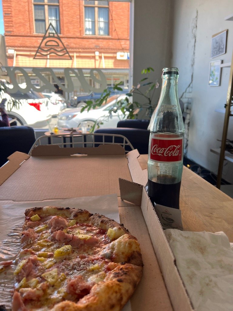
I did not have time to stay long, but I did have time for pizza. Cafe Enza, on East Second Street. Wood-fired oven, the kind of menu that makes you trust the place before you even order. I ordered the ham and pineapple (try before you deny), and a glass-bottle Coca-Cola from Mexico, the kind with cane sugar, which I do not drink often but on a long flying day tastes like a small miracle. The pizza was excellent. The Mexicoke was cold. I sat for twenty minutes and watched the festival walk past the windows.
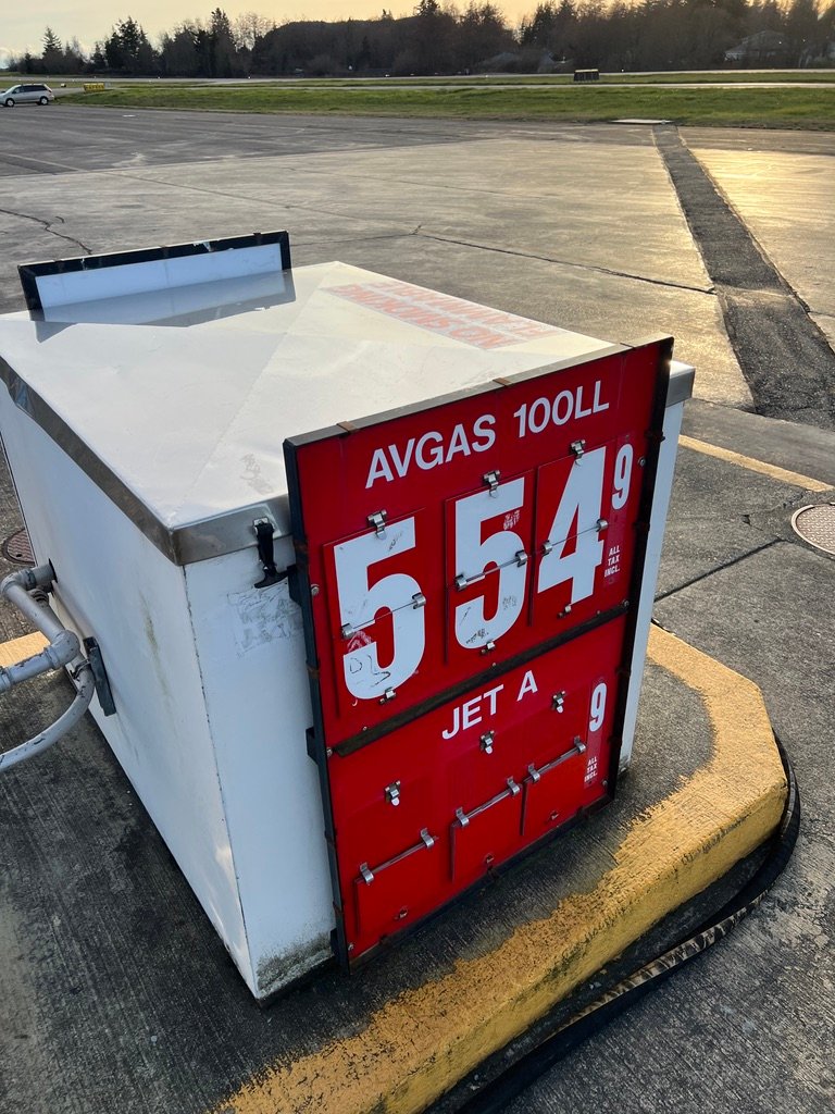
Then I drove back across the bridge, paid for the crew car, topped Thomas off with fuel, and pointed the airplane back at the runway. The day was not over.
Eastbound Out, Westbound Back
Takeoff from 31 at The Dalles launches you directly into the Gorge. There is no easing in. You climb past the brown hills on the south side, the river opens beneath you, and within a minute or two you are flying the canyon you flew earlier in the day, but from the other direction. This is one of the underrated pleasures of out-and-back flying, the same country looks different in reverse. The light is different, the shadows fall the other way, the landmarks present their other side. The Bridge of the Gods looks different from the east than from the west. So does Multnomah Falls. So does Mount Hood, which had been off my right shoulder eastbound and was now off my left.
I had set my route to stop at Ken Jernstedt Airfield (Hood River) on the way back. I am glad I did.
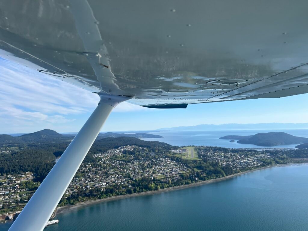
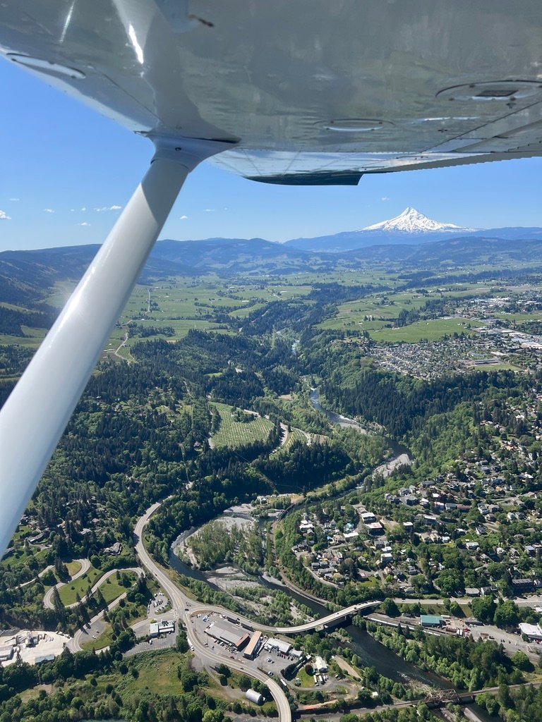
Hood River / Ken Jernstedt Airfield (4S2)
The approach into 4S2 is the more adventurous of the two Gorge airports. The Dalles sits in a wide eastern basin; Hood River sits in a tight valley with rising terrain on both sides. The field elevation is 638 feet, and the Hood River itself winds along just south of the runway. The final approach to 25 crosses directly over the river, which means the air on short final has a habit of doing things the rest of the approach didn’t prepare you for. On this day it was benign. But you fly the approach the way you fly any short, terrain-surrounded approach: airspeed nailed, glidepath disciplined, hands ready for the wind that may or may not arrive.
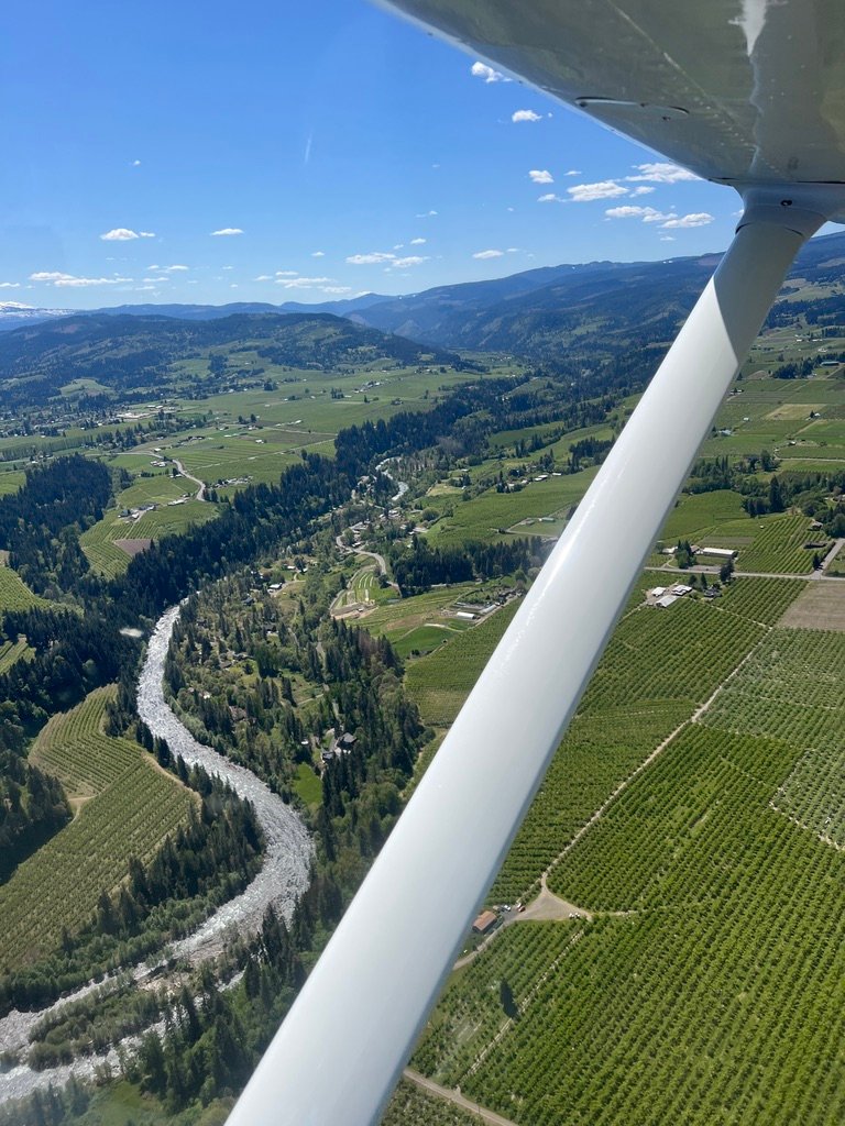
The view on the way in was its own reward. Vineyards on the slopes, the Hood River winding silver through the valley, Mt. Hood pinning down the southern horizon. I made the standard CTAF calls, listened for glider traffic, 4S2 has active soaring operations and gliders fly a right-hand pattern while powered traffic flies left, and landed. The runway is 3,040 feet of pavement, narrower at 75 feet than what I am used to at home but plenty for a 172. I took the taxiway and rolled toward the ramp.
I taxied to the ramp and went inside.
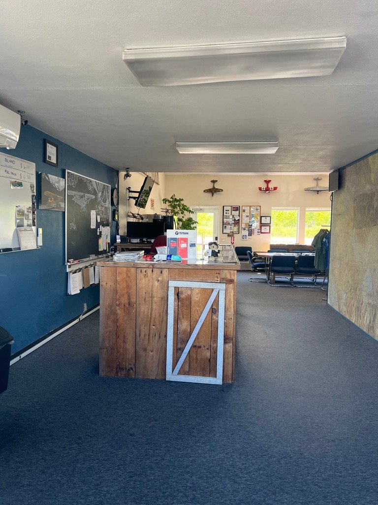
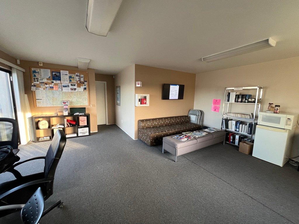
Inside, the pilots’ lounge was everything a small-town airport lounge ought to be. Clean. Quiet. A bookshelf. Coffee on a hot plate. A window onto the ramp where Thomas sat in the afternoon sun. The woman behind the counter looked up and asked where I’d flown in from. Arlington, I told her. She nodded, and then — with the matter-of-fact certainty of someone who had spent more than one summer at this airport — she told me it can get really windy here. She didn’t elaborate. She didn’t need to.
I refilled my water bottle, walked back out, and looked at the field for a few minutes longer than I needed to. There is also a grass strip at 4S2, the Alternate Grass Landing Area, parallel to and just north of the paved runway, and a careful pilot will know it is there and will know that the paved and the grass can’t be used simultaneously. I noted the AGLA from the ramp, the way you note details at a field you may come back to.
This is the kind of airport I love to land at, and I am aware that we live in a time when these airports are not guaranteed. Small fields close. Funding runs out. Communities decide a runway is worth less to them than a development. I do not have a policy prescription to offer about this, but I have a feeling, and the feeling is that we should keep these places. The map of America gets quieter every year. A small airport in a river canyon is not nothing. It is a piece of infrastructure that allows a kind of life — a kind of contact between distant places — that not very many other things allow. I hope the next pilot who passes through 4S2 in twenty years finds the same lady at the same counter and gets the same warning about the summer winds. Or, more realistically, I hope they find someone like her doing the same job in the same way. That would be enough.
Thomas started on the first turn. I taxied to the hold short line and stopped, because a glider was being hooked up to the towplane on the runway ahead of me — the kind of operation you watch with a particular respect because it represents a quieter, older way of being aloft. I held short and watched. The towplane went first, the tow rope tightened with that small inevitable jerk, and the glider rolled forward and then up. Within a minute they were a hundred feet in the air; within two, four hundred. Then they were gone east, climbing into the lift along the canyon walls, looking for their first thermal.
I taxied onto the runway and took off north into the Gorge.
Westbound
The Gorge westbound was as smooth as it had been eastbound. The thermal low east of the Cascades hadn’t built into the kind of afternoon pressure gradient that drives the canyon’s famous gap flow, and the air through the corridor stayed close to calm.
I settled on the right side of the corridor, and let Thomas take me west.
Beacon Rock from the eastbound morning had been the dramatic introduction to the Washington side. Beacon Rock from the westbound afternoon was a different presentation entirely. The light caught the basalt differently, the columnar jointing on the rock’s exposed faces showed more clearly, and the structure of the monolith, the column of an ancient volcano whose softer surroundings had been scoured away by the Missoula Floods, was visible in a way I had not noticed eastbound. Same rock. New picture. The country teaches you that the second look matters.
The westbound run was less of a sightseeing flight than the eastbound had been. There were updrafts near the Portland area as the afternoon thermals built, the air felt busier with traffic, and my attention was naturally on flying rather than on photographs. I picked up flight following from Portland Approach, used the Thorns corridor in reverse to slide around the east side of the Class C, and rejoined the Columbia north of the city. Scappoose was busy with weekend traffic and I monitored the CTAF as I passed it but did not stop. Mount St. Helens off my right wing waved me on.
Toledo, Chehalis, Olympia, the long arc north along the west side of the Seattle Bravo, the Sound widening on my left, the familiar landmarks coming up in reverse.
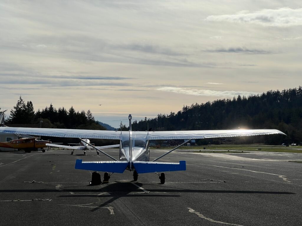
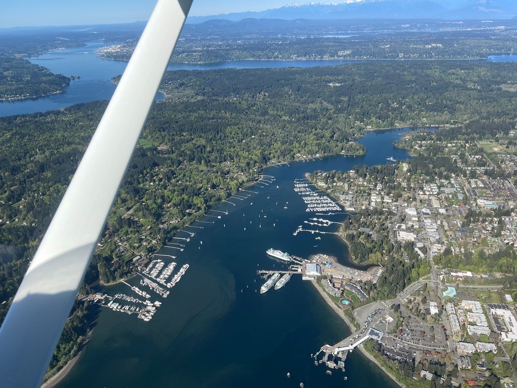
I started feeling like I was getting close to home when Paine Field came up off my right wing, sitting on its elevated bluff above the Sound. Then Hat Island. Then Tulalip. The Cascades to the east were doing their late-afternoon thing: the long backlit ridges, snow holding on the higher peaks, all of it green-shadowed and quiet. Arlington came up the way home airports always come up, not announcing itself, just there when I needed it. I made my radio calls and entered the pattern. The landing was unremarkable, which is how all good landings should be. Thomas rolled out, taxied to his tiedown, and I shut him down.
What I Carry Home
I sat in the cockpit for a minute after the engine shut down. The sound of cooling metal. The whirr of the turn-and-bank indicator gyro spinning down, the long shadow of the wing on the ramp, and the strange feel of sitting motionless in a small plane after a long day flying.
Eight hours, give or take. Two states. One canyon. A pizza in The Dalles. A glider launch at Hood River. A friendly voice on a CTAF telling me which runway people liked. Four mountains, Rainier, St. Helens, Adams, Hood, each one visible from the cockpit at different points in the day. Beacon Rock, Vista House, The Bridge of the Gods passing beneath the wings. A pilots’ lounge with coffee on a hot plate.
Everyone who flies long enough has had a day like this, and the days don’t get old. They accumulate. They make a life. The pilot’s license is a piece of paper that perhaps costs more than it should but is worth more than it costs, and what it buys is not the airplane or the airspace or the destination. What it buys is access: to weather, to country, to the simple geographic fact that this canyon exists and a pilot with reasonable judgment and a reasonable airplane can fly through it on a Friday in the spring.
I am thankful. I do not say this in the church sense, exactly, though I have nothing against the church sense. I say it as a pilot who has had to cancel plenty of flights for different reasons. The airplane started this morning. The weather agreed with the plan. Air Traffic Control was professional and patient. A stranger at The Dalles helped me out with the preferred runway. The wood-fired oven at Cafe Enza did its work. The Northwest Cherry Festival was happening because hundreds of people did the unglamorous work of organizing it. Thomas was, as ever, a really useful engine. None of these things had to go right. All of them did.
The light was lower than I remembered. I locked Thomas up, walked to the car, and drove home.
Disclaimer: I’m a CFI/CFII, but I’m not your CFI/CFII, and nothing in this post is flight instruction. This is a personal account of how I’ve come to fly the San Juan Islands over many flights in the area, written from memory and personal experience. Every technical detail mentioned — runway dimensions, frequencies, airspace floors, traffic patterns, noise abatement guidance, identifiers, distances, anything operational — is recalled from how I’ve come to know these airports, and is not a substitute for official sources. Airport conditions, procedures, frequencies, runway data, airspace, and noise abatement guidance change. Verify everything against the current chart supplement, FAA publications, sectional charts, NOTAMs, AWOS/ATIS, and the airport operator before you fly. Pilot in command authority and responsibility for the safe conduct of any flight rests entirely with the pilot in command. If you’d like to fly the islands with me as your instructor, that’s a different conversation — see the link above.
Bryan Gmyrek is a CFI/CFII based at Arlington Municipal Airport (KAWO) in Snohomish County, Washington. Before becoming a flight instructor, he did particle physics research at Fermi National Accelerator Laboratory and worked as a software engineer in tech. He owns and operates Emerald Air LLC.
A note for fellow pilots: this flight covers ground that I also teach as a one-day course out of KAWO in Thomas. If that’s of interest, check out this page.
© 2026 Emerald Air LLC. All rights reserved.