River Corridor Navigation, Coastal Weather Transitions, and Marine Environment Flying
The lower Columbia River and Oregon coastline present a training environment that’s unlike anything in the Puget Sound lowlands. You’ll navigate a major river corridor where the weather transitions from inland to maritime conditions in real time, then practice coastal flying techniques along a shoreline where fog, onshore flow, and changing ceilings demand constant assessment and decision-making.
This course builds the specific skills that coastal and river corridor flying demand — weather transition recognition, shoreline positioning, marine weather interpretation, and the adaptive planning that makes cross-country flying in varied environments safe and repeatable.
Your Day
Arlington to Kelso — Depart KAWO and head south, navigating airspace transitions and settling into cross-country operations as the terrain opens up.
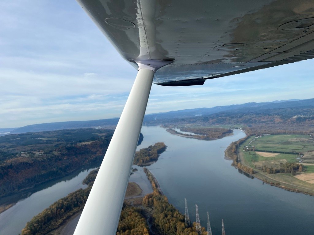
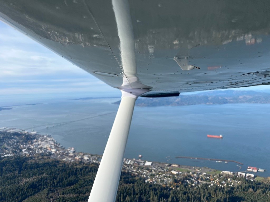
Kelso to Astoria — Pick up the Columbia River at Kelso and follow it west. This leg is focused on river corridor navigation — using terrain features for position awareness, reading surface wind indicators on the water, and managing the progressive weather transition as maritime influence increases toward the coast. You land at Astoria (KAST), near the mouth of the Columbia.
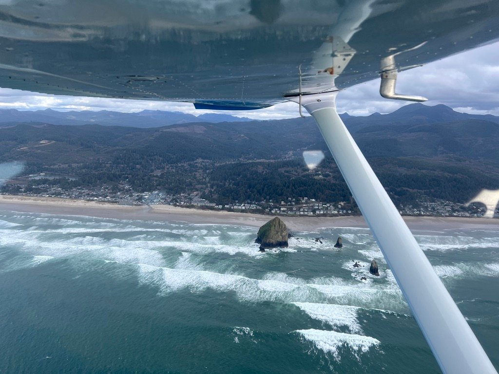
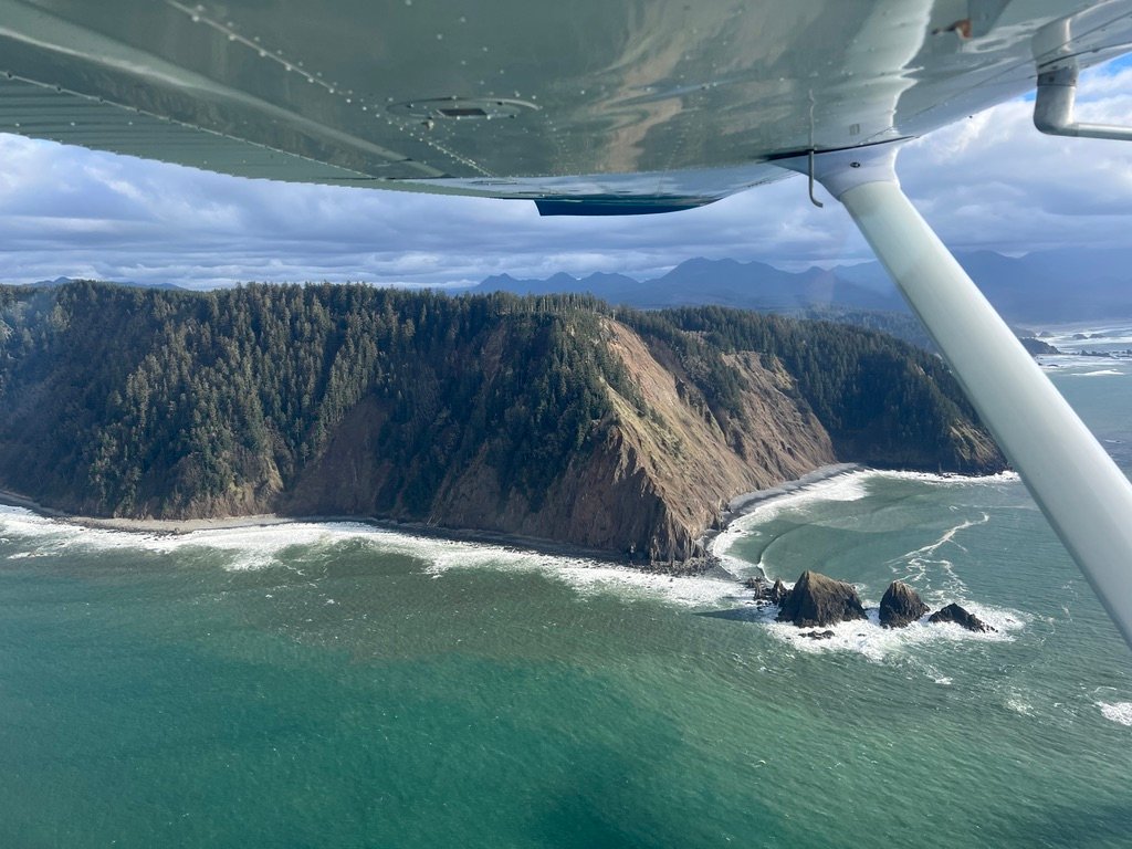
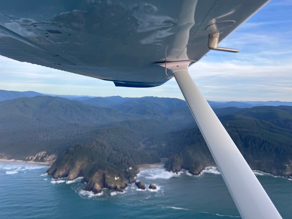
Coastal Operations — From Astoria, fly south along the Oregon coastline. This is the core coastal training: evaluating marine layer conditions, maintaining position awareness relative to the shoreline, assessing terrain and weather for go/no-go decisions, and practicing the continuous risk evaluation that coastal flying demands. You’ll navigate past prominent coastal terrain features used for position reference before turning north.
Return — Head back north along the coast and up the Columbia corridor, reinforcing the skills from earlier in the day from a different direction and with evolved conditions.
What You’ll Learn
River Corridor Navigation — The lower Columbia is a major geographic feature that channels weather and wind. You’ll learn how to use river terrain for navigation reference, read surface wind from water indicators, and manage the weather transition from inland to maritime conditions.
Coastal Weather Assessment — The Oregon coast is where Pacific marine air meets the continent. Fog, low ceilings, and rapidly changing conditions are normal. You’ll learn to interpret coastal weather reports, recognize visual cues of deteriorating conditions, and make timely go/no-go decisions.

Coastal Flying Techniques — Shoreline positioning for maximum safety margin, altitude management in a marine environment, and how to evaluate your options when the terrain on one side is water and the terrain on the other side is forested hills.
Cross-Country Planning and Execution — A full day with multiple legs, fuel management, and weather that evolves throughout the flight. You’ll build the adaptive planning skills that separate pilots who fly complex trips from pilots who stay close to home.
Real-World Communication — Multiple airspace types and frequencies over the course of the day. You’ll build comfort working the radio in unfamiliar environments.
The Details
| Departure | Arlington Municipal Airport (KAWO) |
| Route | KAWO → KKLS → KAST → Oregon Coast → KAWO |
| Flight Time | Approximately 4.5 hours |
| Ground Instruction | 2 hours |
| Aircraft | Cessna 172G — dual Garmin G5s, Garmin 175 GPS |
| Prerequisites | Private Pilot Certificate w/ current medical (OR Sport Pilot certificate/privileges) & flight review. Checkout in the Cessna 172 also required. |
| Price | $1,300 (includes aircraft, instruction, and refreshments) plus cost of 172 checkout unless you’ve already completed the checkout recently or fly in the school 172 regularly. |
| Certificate | Certificate of achievement awarded upon completion |
Have your own airplane? This course can be done in your aircraft. Contact me for instruction-only pricing.
Who This Is For
You’re a certificated pilot who wants to build coastal and cross-country proficiency. Maybe you want course navigating river corridors and transitioning between weather environments. Maybe you’re planning future coastal flying and want a solid foundation in marine weather assessment. Or maybe you’re working through the full set of Pacific Northwest training courses.
Visiting the Seattle area from overseas? If you hold a foreign pilot certificate, you may be able to train along the Oregon coast through the FAA’s license validation process. Contact me and I’ll help you figure out what’s needed.
Book This Course
Works best late spring through early fall when daylight and conditions cooperate. Marine layers are common on the Oregon coast, especially summer mornings — we’ll plan timing carefully. Get in touch and we’ll find the right day.
Important Information
All courses are subject to weather conditions and aircraft maintenance availability. A liability waiver must be signed prior to the flight. Full pre-payment is required to reserve your date. No-shows will result in forfeiture of payment. If weather or maintenance prevents the flight, we will reschedule at no additional cost.
Webpage and Course Structure and Material Copyright 2026 Emerald Air LLC, All Rights Reserved.